Tuesday, September 20, 2016

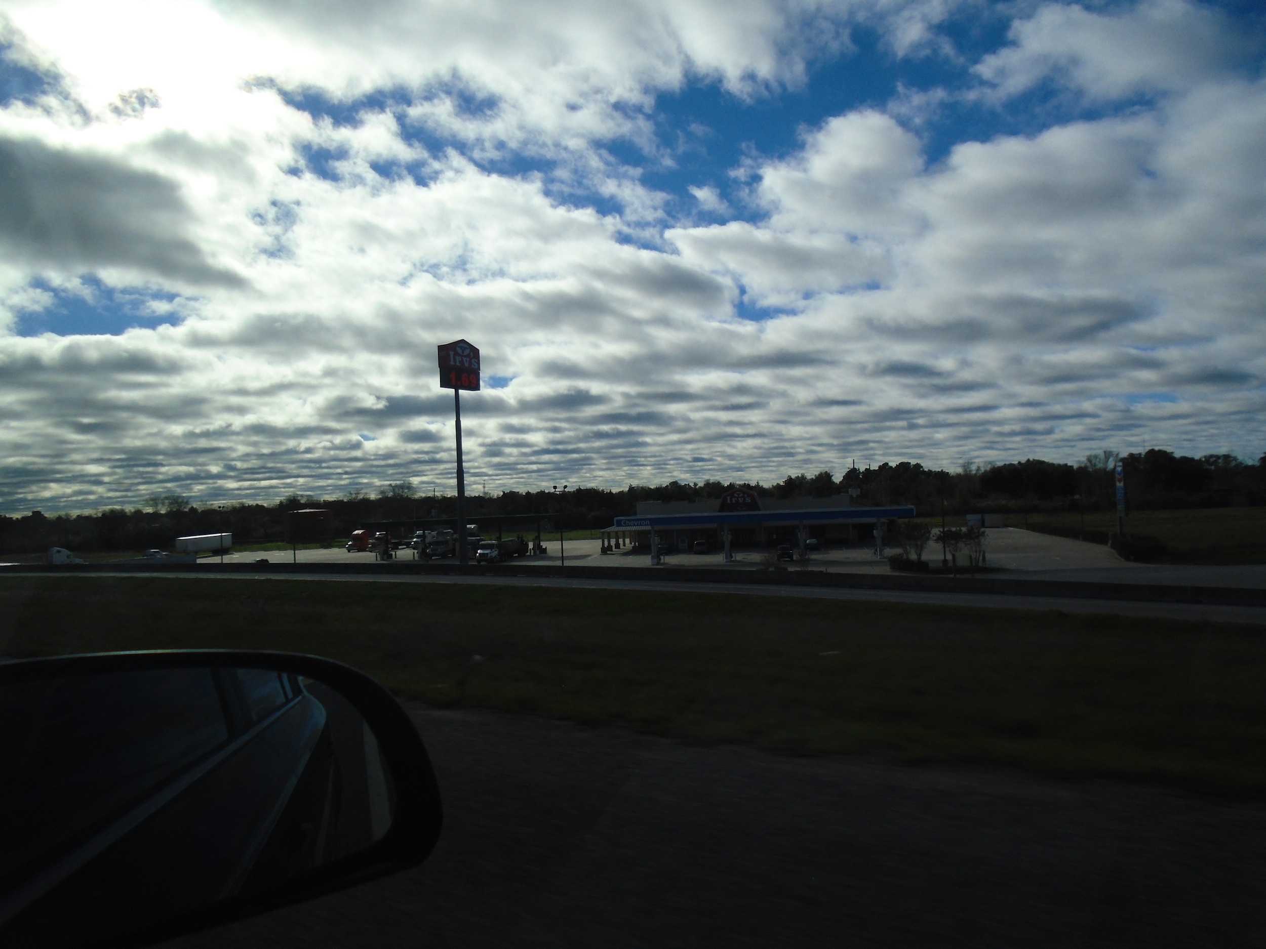
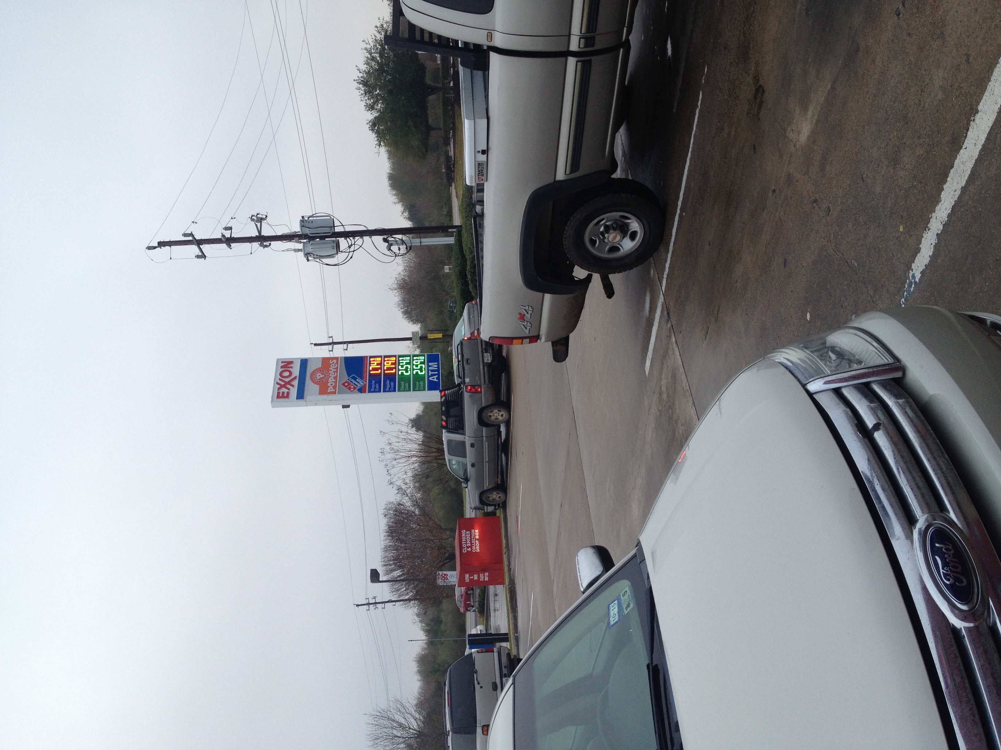
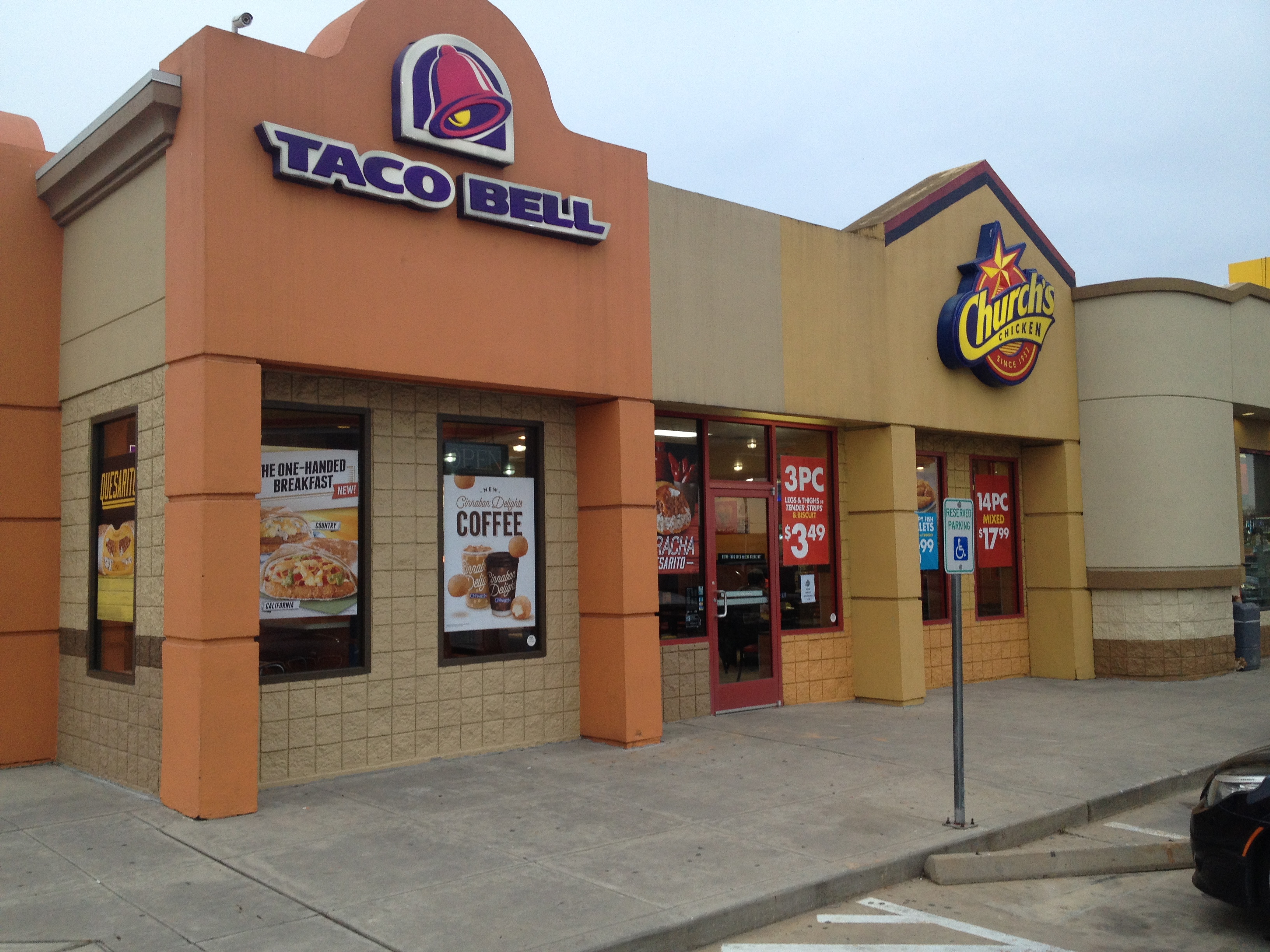
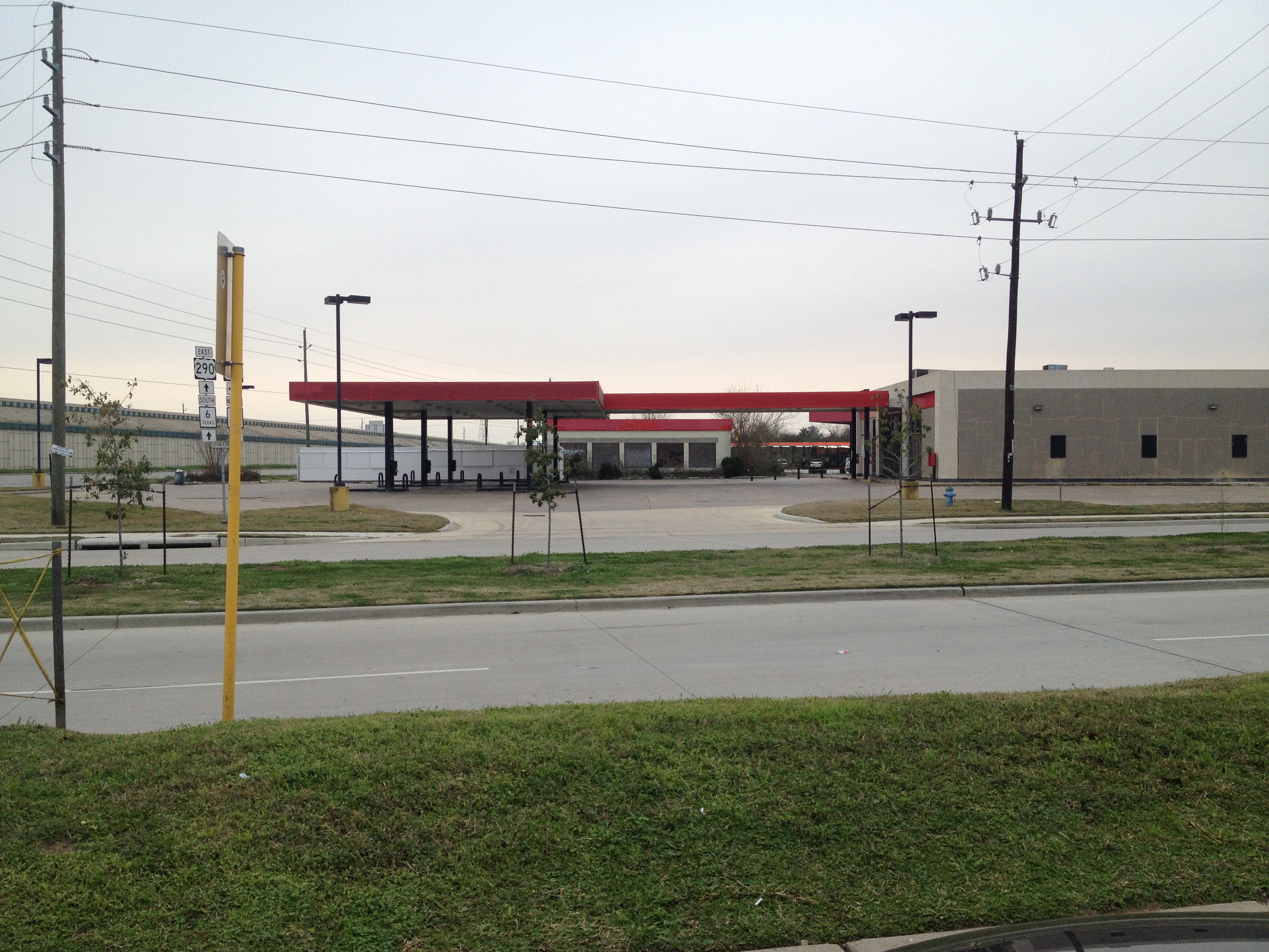
Welcome. You are about to read the Northwest Freeway Corridor blog, one of the most extensive pages on an American highway. In fact, I dare say that you can read and absorb everything in more time than you'd take actually driving the thing. This blog, originally a single HTML page, is a bit long because it covers about 45 miles of freeway. A bit of introduction: originally, it was supposed to be a simple list of buildings cleared in the 290 expansion project with some photos. Like the Interstate 10 widening a decade ago, there could be many, many casualties, almost certainly including single family houses (and as of summer 2015, those have happened). Sometime after the original project started, Erik (Oscar) Slotboom released his own pictures inspired by this very page, which are great--they have a lot of things I missed. Even though this page came first, I felt like I wasn't going to be able to compete with that, and eventually stopped updating my list, exacerbated by the generally poor data I've gotten (finding out when everything was built would require a LOT of HCAD-digging). This celebrates what is there, what has been there, more information on them, and a personal perspective as well. I also want to avoid covering the same ground as West Houston Archives, but even West Houston Archives originally didn't cover as far out as this page originally did (it still doesn't). Consider this your ultimate guide to both the freeway as it is now and an excellent historical reference. You will notice that in some areas the guide isn't 100% comprehensive. I do take requests if you want something to be covered though.

This used to be a single page. Note that the dates added aren't accurate, they're all 9/20/16 for the interest of keeping the order of the page. Also note that some sections may be out of date due to the changing nature of the freeway and the businesses.

Last Updated: January 10 2020 (Monterey's Tex-Mex picture in the last section)

The Index is as follows.

Highway 6 North (or keep reading down)
FM 1488
FM 1098
FM 362
Fields Store Road (added late November 2016)
Waller-Tomball Road / AJ Foyt Parkway (FM 2920) (added March 26 2017)
Binford Road and Kickapoo Road (added March 26 2017)
Hegar Road (added March 26 2017)
Betka Road / Badtke Road (added May 12 2017)
Roberts Road / Katy Hockley Road (added May 17 2017)
Becker Road (added June 3 2017)
Grand Parkway (added November 23 2017)
Mason Road (added February 18 2018)
Mueschke Road (added March 15 2018)
Cypress-Rosehill Road / Fry Road and Spring Cypress Road (added March 19 2018)
Skinner Road (added March 25 2018)
Barker-Cypress Road (added March 29 2018)
Telge Road (added September 17 2018)
Huffmeister Road (added November 18 2018)
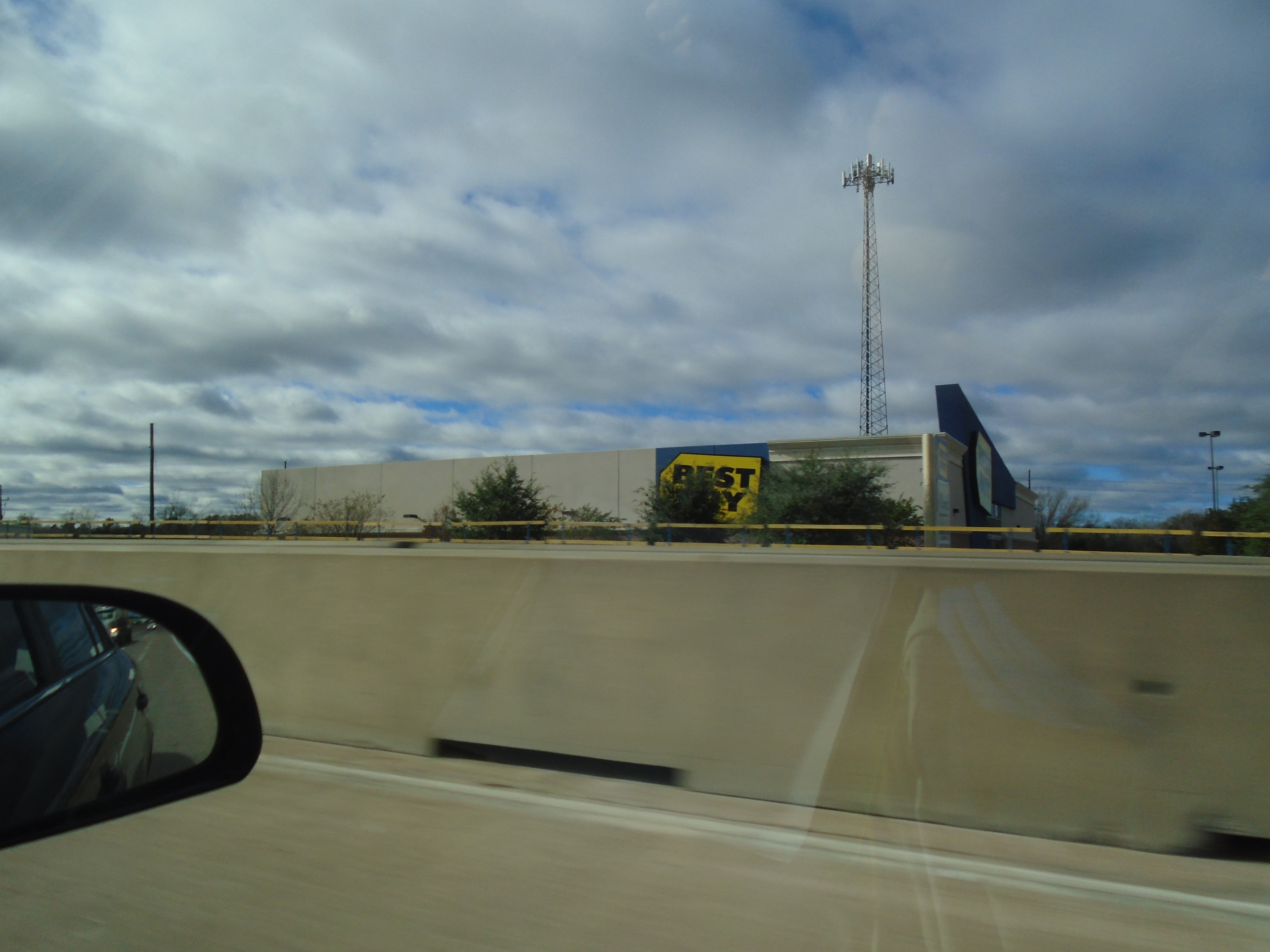
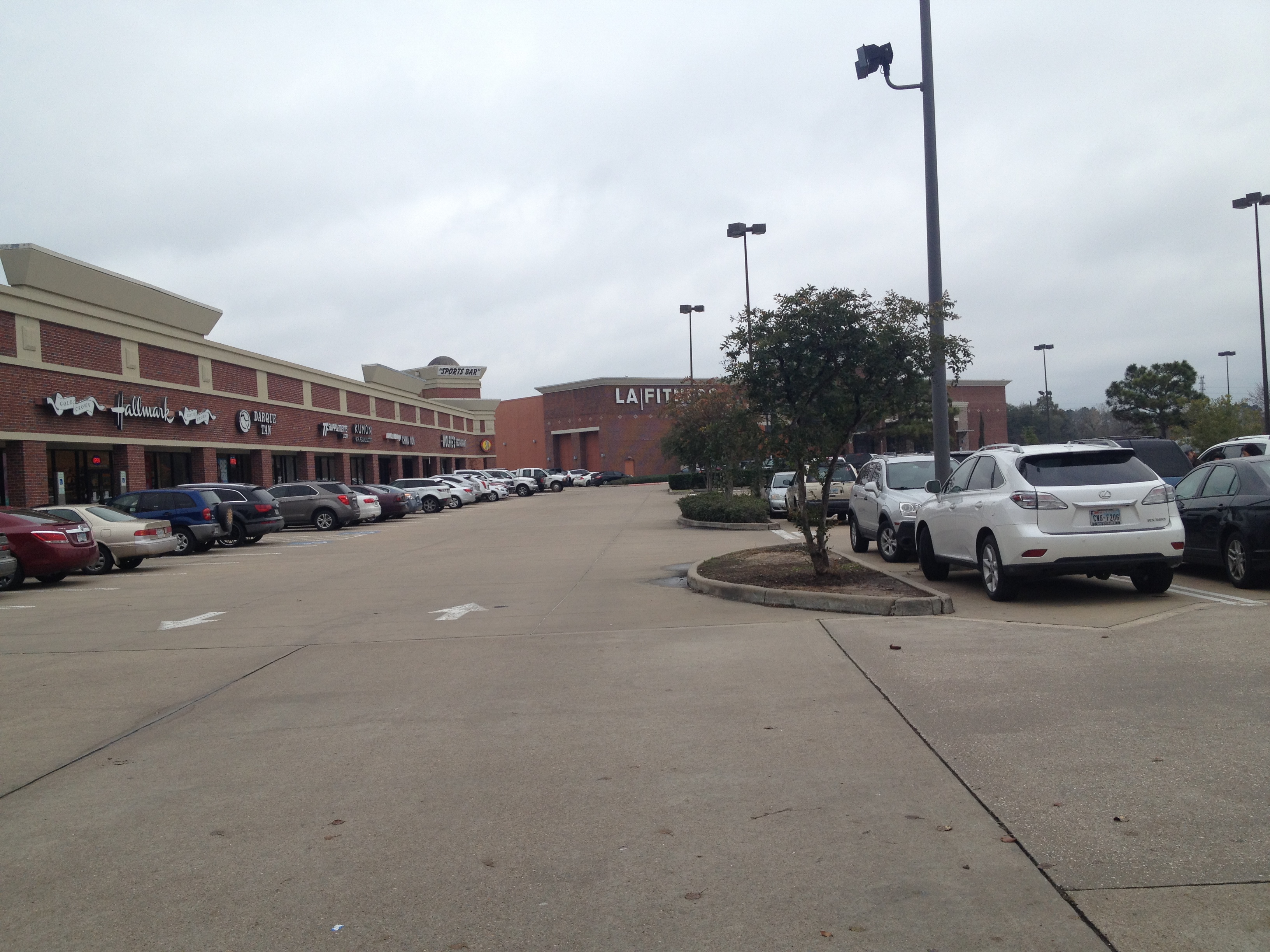
FM 1960 / Highway 6 South (added February 4 2019)
North Eldridge Parkway and West Road (added April 25 2019)
Jones Road (added April 29 2019)
FM 529, Senate Avenue, and Sam Houston Parkway (added June 22 2019)
West Little York Road and Gessner Road (added July 2019)
Fairbanks North Houston Road (added August 21 2019)
Tidwell Road and Hollister Road (added November 19 2019)
Pinemont Drive, Bingle Road, and West 43rd Street (added December 31 2019)
Antoine Drive and West 34th Street (added January 6 2020)
Mangum Road and Dacoma Street (added January 6 2020)

Highway 6 North

While U.S. Highway 290 actually extends to west of Fredericksburg, we won't be covering that. After all, if you keep following west, you'll have to take an exit at Brenham to continue west. The road will go north as Texas 36, including the terminus of FM 60 (University Drive). There are actually five distinct segments of U.S. Highway 290 between its two access points off of either end of I-10 (which itself is a different distinct segment).

Our story actually is between Hempstead and Houston. As a younger person, going to Houston was somewhat of an adventure. Rarely did we actually stop in Houston (mostly a pass-through en route to Galveston) but Houston represented more than that. While Florida (see my other blog for a reference to that) and Louisiana were more exotic in their own ways , Houston was more of a superior example of what my town could be, with pretty much everything that College Station/Bryan had but much much more. Every type of store and fast food restaurant could be found there, there was more trees, skyscrapers, and generally what my town could aspire to be. My mother, of course, was horrified at these prospects, and frankly, with the historical high crime and pollution (as well as the ever-present contemporary problem of traffic, something that BCS would gain soon enough), she had a point.

Getting to 290 was the first part of the journey, and required a 35 mile trek through predominantly rural highway. And then we would see it...a ramp, jutting three full levels up into the air and curving the entire way into 290 East. Today, they have little dividers to mark the ramp (those didn't appear until some point after spring 2008 but not much longer afterward). Symbolizing this great change from the rural Highway 6 to the wide, smooth environs of Highway 290 was the massive Lawrence Marshall Hempstead car dealership. "We clobber big city prices!", they bragged, advertising to Houston and College Station while giving the Hempstead economy a big boost. Well, that didn't work out when the auto industry imploded. LMH closed in February 2009 and over the next several years, I would watch sadly as the place started to deteriorate, as the banners of the auto makers faded and eventually fell off (you can see them with the slider feature on Google Maps Street View). There was also a large electronic sign to be seen as one accelerated onto the highway. As of August 2016, there is now BARRY Fleet Services taking up part of the Highway 6 side of the vast complex.

Still, you could see a large McDonald's/Exxon sign in the distance, and the adventure began...

Next Exit: FM 1488 (or scroll down)


Back to Intro

FM 1488

That McDonald's/Exxon sign carries a lot of nostalgia. (February 2014)


While you can see the signs from the ramp from Highway 6 to Navasota (and ultimately, to Waco, as just sticking the road ultimately terminates at I-35). FM 1488 is mostly Hempstead's collection of highway gas stations and restaurants, and further along, it does connect to the other highways and neighborhoods in the northern outreaches of Houston, but it's not usually used as a loop road.

Eastbound (South)
1945 FM 1488 - This Shell gas station originally included a Long John Silvers inside (a bit uncommon, especially for gas stations), though it was fully integrated into the gas station (no semi-separate building from the looks of it), meaning the whole store probably smells like greasy fried food (although that may be an improvement from the normal convenience store funk). An actual stop to the store in mid-March 2016 revealed that the store was in the midst of changing it to a Chesters Fried Chicken. Signage on the inside was gone, and there was an employee meeting going on. Despite that, there's a lot of LJS décor leftovers inside, or at least the last time I looked. As of summer 2017, Chesters is already out, replaced with "Southern Kitchen Kountry Cooking", a one-off which advertises barbecue.

1925 FM 1488 - Until September 2016, I never went to this Jack in the Box. When I did, I found it remarkably similar to the other one at Waller, and today I prefer this one on my Houston trips since it's much easier to get in and out, and less crowded.

Westbound (North)

220 Cottonwood - A DaVita Dialyis built here in spring 2015, I was expecting this (when it was under construction) to be a restaurant of some sort. Not exactly a roadside stop, unless you had some sort of medical emergency, I guess.

210 Cottonwood - The modestly popular Hempstead Seafood & Steak restaurant is here (though it appears to not use the whole space). I have yet to get a good picture for this one.

2000 FM 1488 - Hempstead Truck Stop as it was known, combined an Exxon sign and a McDonald's on its fading dual-pronged sign, and it was a great reminder to the road trips I took with my family in the late 1990s and early 2000s, including (but definitely not limited to) the Houston area. Imagine the hole in my heart when I drove up around December 2017 to find that the Exxon sign and the price display was missing, leaving a lopsided lone McDonald's sign there.

While Exxon/McDonald's combos are relatively common, the Hempstead Truck Stop originally was combined with a Denny's, which had the address of 100 Cottonwood rather than 2000 FM 1488. The McDonald's is located next to it (and it appears to have been renovated between 2012 and 2014). From what I've heard on Yelp, the Denny's was terrible (dirty, poor service, still has smoking allowed inside), worse than your average Denny's restaurant (not great to begin with) and sometime in early 2016 (February or March) a Subway was added to the complex on the side of the building closest to the freeway. Unlike Denny's it shared the address of the truck stop but it also did not connect to the gas station. (Cottonwood is the small access road between the truck stop and the westbound on-ramp). At some point (I want to say near the end, because I didn't really notice it until then) they did have a Krispy Krunchy fried chicken program going on.

A drive-by in June 2017 revealed that sometime in the spring, Denny's had exited and was replaced with "Country Delight Cafe". It was a sign of things to come before the whole thing was closed, except for the Subway (oddly enough). A picture I have from January 2018 (not added to the site unfortunately) showed the gas station had been demolished interior-wise, except for Subway. Subway's facade is missing and it can only be accessed from Cottonwood.

I don't know when Hempstead Truck Stop opened (there's another "Hempstead Truck Stop" in Hempstead proper but we're not covering that road) but Waller County Appraisal District says the year 2000.

When I visited in February 2018 again during demolition (the main building was completely gutted), I found out that the Subway had never been part of the main gas station, having been carved out of space that was once presumably Denny's seating. From what I've figured based on what I remember passing by there was a door that opened to the west (facing 290) and that was where Denny's was, then you would get to the main store on the other side, where the FM 1488 entrance was. When the Subway was added, a portion of the Denny's seating in the southwest part of the building was removed and converted. When the gas station was rebuilt by summer of 2018, the new Pilot Travel Center featured a Dunkin' Donuts kiosk and Pilot Flying J's "PJ Fresh" concept.

2100 FM 1488 - The McDonald's was built around the same time as the truck stop but renovated (no mansard roof) around 2013-2014.

2045 FM 1488 - The Sonic was built in 2001.


DIRECTORY
<< Back to Highway 6 North

>> Next Exit: FM 1098

FM 1098

You can't even see the sign in this 2014 picture.


When I was a boy, I used to think that this was the first sign of civilization, only to find more open fields open. Now, due to gas stations built since, that's becoming less and less true. Funnily enough, one of my friends who lived in Texas had thought the same thing in the early 2010s!

It features a once rather attractive late 1990s build underpass (the only depressed underpass along 290, at least until Brenham), though it is a bit worse for the wear today, unfortunately, and the main access road to Prairie View A&M University, a historically African-American campus originally created as the segregated "colored" counterpart to what is now Texas A&M University in College Station.

608 University Drive - Originally opened as Williams Fried Chicken in 2002 (source, archive), a Frenchy's was here from around 2011 to 2012, and reduced to rubble by the end of 2013. A tarp eventually covered the progressively darker and grimier sign by 2016.

DIRECTORY
<< Back to FM 1488

>> Next Exit: FM 362

FM 362

Buc-ee's is hard to capture because it's so large (looking east in March 2015).


I've always felt that the FM 362 overpass (heading eastbound) goes way too high with sharp dropoffs before adding guardrails at the very top (at least they have shoulders), moreso than other overpasses in this part of 290.


=Eastbound (South)=
20727 FM 362 - Waller County Line BBQ, a large Exxon (as of summer/early fall 2019, formerly a Shell) station, this was slightly expanded (based on roof and pavement color differences) in the time span between 1995 and 2003. They have survived the arrival of the beaver's gas station, but I can't imagine they were very happy about it. This is a picture from February 2014 of Waller County Line BBQ from the highway (sorry for the quality). The address is also home of Cedar Creek Saloon, which does not connect with the convenience store/restaurant portion of the gas station. This is your typical smoky poorly-lit honky-tonk with pool and cheap beer.

=Westbound (North)=
40900 - Once Buc-ee's opened, it quickly became a near-regular stop on the highway. Based on what I can find, it appears to have opened in late 2013, though I swear I remember it opening earlier that year (just a little). It advertises (at least until it became common knowledge, or I could be just getting used to it) even on Highway 6 South as "Waller You Waiting For?" I love this store and has become a regular stop in returning on the 290 corridor. At least three times (as of last time I kept count, which was a while back) I have eaten here for their awesome club sandwiches and in-house potato chips, though I gotta admit, I've had a number of "bad chips" (almost consistently per package) where it somehow doesn't get cooked properly and ends up having the texture of folded paper. It was definitely disconcerting for the first time, because I couldn't see them while eating. True story: I remember actually exiting the highway to try to spit out what I thought I was a napkin I had accidentally ingested. I have a few pictures of this Buc-ee's, but not from the highway. Buc-ee's is hard to capture because it's so large (looking east in March 2015). Here's another picture looking back at the beaver statue to the west (also in March 2015).

Swamp Shak (20797 FM 362) - The Swamp Shak seafood restaurant appeared sometime in early 2015, though a Yelp review seems to indicate they've been active since April 2014. Normal activity stopped around 2016 (the Facebook page confirms this), though current signage on the restaurant (defunct) indicates its used as a fireworks stand seasonally.

<< Back to FM 1098

>> Next Exit: Fields Store Road

Fields Store Road

As of this writing, the exit to Fields Store Road is closed, and the outer eastbound lane where this was taken has moved to the former inner shoulder of the westbound lane.


Until the construction of what is now Irv's began construction, Field Store Road was solely access to Waller proper with no freeway-side attractions (well, except an LDS church and an elementary school).

Eastbound (South)
40203 - Field Store Road got its start as a freeway destination when a small gas station (Chevron brand) began building on a cul-de-sac created during freeway construction. "Rocky's B-B-Q Grille" opened in summer 2010 but within its first few years, it changed hands and became Field Store BBQ (at least by my memory...for some reason I remember being it under construction in early 2009), then Irv's Field Store by 2013, then eventually simply Irv's with a repainted red sign by August 2014. Not long after it was simply "Irv's", construction began next door which by March 2015 was revealed to be a new gas canopy with diesel (the canopy is a simple green one) with a large concrete pad for trucks. That's right: they "upgraded" to being a truck stop. For Irv's, I actually have before and after pictures. Here's my picture from May 2014, back when it was still Field Store. Notice obviously-tacked-on later "Irv's" sign. My second picture comes from December 2015, with what Irv's looks like today. Sorry it's a bit darker (a lot darker, actually) than it should be, it was a new camera. In 2019, Waller began to build a water tower behind the gas station. A visit showed that Irv's has some video gambling machines, but don't get too excited, they're for entertainment use only with small, non-money prizes.

Westbound (North)
40202 - The opposite direction has a building called NCI Metal Roofs. I'm not sure when it was built, but it was prior to 2003 (though if it was always that case, I'm not sure). [UPDATE: For some reason, around late December 2018 or early the next month, the signage color changed.]

<< Back to FM 362

>> Next Exit: Waller-Tomball Road/AJ Foyt Parkway

Waller-Tomball Road / AJ Foyt Parkway (FM 2920)


I know that as of this writing the exit is closed (well it was as of early February) but this intersection has become a common stop. When I was doing interviews in Houston (and later living in Houston, if briefly) the Jack in the Box was a common stop here. Most notably is a huge Exxon sign advertising Exxon and Popeyes (the Popeyes sign finally changed to an updated logo, which was a bit disappointing as far as familiarity goes) and then the Domino's Pizza (the diamond-shaped logo) below that. The businesses are off of Stokes Road, which may have been intended as a frontage road at one time but is a separate access road.

The eastbound businesses are as follows:
CVS/pharmacy (31013 FM 2920) moved from a strip mall location circa 2005 that was only briefly a CVS (virtually all CVS stores in Texas prior to 2004 were Eckerd drug stores) down the road to this location. I've stopped here at least once. It probably doesn't see as much freeway-side traffic as the fast foods and gas station does, but it serves a purpose for those things drug stores have that convenience stores don't (hey, I stopped there once), and it serves local Waller interests as well. It isn't very busy.

Jack in the Box (31014 FM 2920) used to be my Dad's stop when heading down to Houston and later was adopted by me. The first time I actually remember going in to the store was as far back as 2009, when they were advertising the HangInThereJack campaign, which would ultimately result in altering the logo of Jack in the Box, and within a few years that would sweep the chain. I don't know about the logo change, to be honest, it took me a few more years to get to used to it, but this is one of the places I always stop these days. On the wall it mentions what its first year was but for some reason I don't have that recorded here.

Exxon (31100 FM 2920), as aforementioned, is actually in a large plaza featuring a Subway, Sakura Nail Spa, and a local doughnut place called Donuts Delight. Popeyes is there too, but it's not connected to the inside of the convenience store, Town & Country Market. I have one shot of the gas signage when gas prices began to go down around late 2014 (January 2015 picture), though on my iPhone, reds display as oranges. I'd have to say that the gas station (minus Subway, which was built later...probably why it lacks co-billing with Exxon) probably came in-line in the late 1990s, though don't quote me on that.

In previous versions of this page, I stated that "none of the food establishments are accessible from inside the convenience store", but that's not true, it actually does have a Domino's inside, but it's just a counter inside the store.

Shipley Do-Nuts (19757 Stokes Road) opened around 2013 or 2012, and is the furthest from the highway access. I stopped here once in early 2015 as a day trip and got an apple fritter. Since then I've dropped by once or twice for a donut. It's closed from mid-day on, so if you want a donut, get here early.

Americas Best Value Inn (19777 Stokes Road) is also slightly newer (new being a relative term); it appears to have been built in 2005. (This is an addition to the blog, it wasn't covered in the original page)

Just a bit farther (past the entrance) is the Walker Veterinary Hospital (38111 US-290), it seems to share the original rectangular plot of land US-290 cuts through and Topper's Camper Center (see our next page) shares.

On the westbound side sits just one business, the Love's Travel Center (30710 FM 2920), which has an Arby's inside. I've been here a few times but I rarely stop at it (usually prefer Buc-ee's). As a truck stop, its merchandise mix is a bit more interesting than the usual convenience store fare, but the restrooms aren't that great, the prices aren't that great, and I don't really care for Arby's as a fast food option (probably why they seem to have closed a lot of locations in the last few years). It can be seen on the left side of the distant shot looking toward the Exxon.

<< Back to Fields Store Road

>> Next Exit: Binford Road and Kickapoo Road

Binford Road and Kickapoo Road

I write this with a bit of a tear in my eye, as I fondly remember heading back from Houston on Spring Break trips (2008, 2009, and perhaps others) I would see Binford and Kickapoo Road as the sun was starting to set. They were just two different roads in the countryside, well out of the hustle and bustle of Houston and its suburbs, with funny names and bulging out near the highway to four lanes before shrinking down to two. In 2015, that would all change with the building of the ComfortPlex (19001 Kermier Road): this mega-structure, a new HVAC factory/office campus. I can't tell what's worse, the continuing sprawl of Houston or the fact that it will drag traffic out here, or the fact that even "rural" in recent memory is once again being dramatically transformed (see Mason Road, below). And of course, those two lane roads have been widened to modern four lane roads, and stoplights have been added. At least Kermier Road just east of this retains this layout. There's no EB/WB designation for this one because it will catch your eye either way. The road curves. (Sorry I don't have a picture for this one, guys)

<< Back to Waller Tomball Road / AJ Foyt Parkway

>> Next Exit: Hegar Road


Hegar Road

Last interchange before it merges with Hempstead Road/starts following the railroad line. Note that Bauer-Hockley has a wooden bridge near its curving into Grimes, which is rare for this day and age. Around late 2015 construction began in this area.


<< Back to Binford Road and Kickapoo Road

>> Next Exit: Betka Road/Badtke Road

Betka Road / Badtke Road

About the time 290 became a full freeway, the railroad crossing was rebuilt to allow a full four-lane road later on. It's nice future proofing, but one wonders why they also didn't do this for Becker Road further down. This intersection also marks where Hempstead Road rejoins the freeway. The westbound lanes were removed but the two eastbound lanes become the new two lanes for the frontage road all the way to at least Mueschke Road. For a time in the late 1990s and very early 2000s, before the actual freeway portion was built in this section but after the bypass to Hempstead was built, the highway abruptly dead-ended as an entrance ramp took you onto the not-yet-a-freeway 290. Unfortunately, we don't have any aerials of what that looked like, all we have is some blurry undated photos by Marty Blaise.


<< Back to Hegar Road

>> Next Exit: Roberts Road / Katy-Hockley Road

Roberts Road / Katy-Hockley Road


We're getting closer to the Grand Parkway.
The Eastbound (South) side features a large concrete plant, Hanson Aggregates of Hockley (16910 Katy-Hockley Rd.) featuring a large, circular railroad spur (since it loops, it can't accurately be called a spur now, can it?) though right near it is an abandoned ROW that led out to a salt mine (which still exists).

The Northbound side has a large stone building (33400 U.S. Highway 290) that is currently home to "Sutong Tire Resources Inc." and originally opened as D&D Farm & Ranch Supermarket in 2001, which was billed as the world's largest western store upon opening and sold upscale western-inspired clothing, many of which consisted of, and I quote, "music-star jeans". The store also sold actual farm-related equipment including saddles, fencing, and home furnishings (but no food, ironically). D&D eventually moved on (it appears to be in Seguin now). By November 2005, the space reopened as Sergeant's Western World, which was in many ways more of the same but focused more on horse equipment and custom saddlery, with Western apparel and everything else following behind. I remember passing by Sergeant's in January 2009, when it was going out of business. It was replaced by Foster's Farm & Equipment store soon after. Foster's remained until sometime in late 2015 and was superseded by its next-door neighbor, Brookside Equipment Sales, with Sutong appearing by December 2016.

The stoplights here have flashing red beacons.

<< Back to Betka Road / Badtke Road

>> Next Exit: Becker Road

Becker Road

Becker Road is the first interchange with "real" things on it these days (and it's been four-laned as of 2012-2013). In the old days of pre-freeway 290, this was another troublesome area as the two sides of Becker Road did not continue straight across 290, requiring a slight bend in the road over the highway median, with this oversight only being fixed when the road was four-laned.

=EASTBOUND (SOUTH)=

Community of Faith (16124 Becker Road) - A church (not related to The Community of Faith in Houston proper) which has a massive facility (originally built circa 2007 and built an expansion as of spring 2015), a super-stylized cross (shaped like a boomerang) and a bright electronic display screen which was toned down around late 2014 since drivers don't like a miniature sun 24/7 just off the freeway that's ten times worse when it's foggy.


=WESTBOUND (NORTH)=
Shell (32150 US-290) - I've gotten relatively cheap bottled water here (at least for gas station standards). The truck stop features a Taco Bell and Church's Chicken inside, though it's just two counters in a common seating area (and not particularly well-lit). Here's the front of the fast foods from the outside (taken 2/2015). If you're coming from West Houston Archives, you'll notice that the Taco Bell sign is now painted more of an orange color (I'm pretty sure it's not just the sunlight) and has lost its "Express" moniker.

Exxon (32202 US-290 Bldg. A) - An abandoned truck stop, "290 Express Way", which closed, according to Google Maps Street View, between early 2011 and early 2013). The truck stop originally opened between 1995 and 2004 and looks like it's been closed for a couple of years. The only reference I can find is a 1999 article where the owner described the major accidents happening at Becker Road, since it was not a freeway at the time nor had lights. I don't know why it closed, either problems stemming from the widening of Becker, or the fact that it may have been a less attractive option than Shell, as a good truck stop usually requires a prominently advertised restaurant option (usually fast food, but not always). A few photos I have (all from 2/15) include the empty canopies of the Exxon, the fading and deteriorating billboard, and the Exxon roadside sign—note the older Sonic in the background with the red and yellow neon.

Sonic Drive-In (32202 US-290 Bldg. B) - This Sonic looked like the older prototype of Sonic stores but is still very much open. I noticed as of June 2017 they finally did update the red and yellow perimeter neon to the modern Sonic prototype of the gray plastic tubing or whatever (yeah, I know that's an unflattering term). Despite the fact that it looked pretty old, it actually wasn't, it was actually built in 2004-2005.

<< Back to Roberts Road / Katy Hockley Road

>> Next Exit: Grand Parkway

Grand Parkway

No picture available, so we'll have to use one from the Houston Chronicle.

From some pillars in December 2011 to a huge interchange just two years later, this has long plagued 290 with concrete barriers, temporary lane markings, zero-distance merging lanes, and more (though it's gotten better). And it's not even a five-stack like they promised, which is hopeful in some ways as there are a number of bad designs around TxDOT projects that need to be substantially altered. This creates a major dividing point in the US-290 story and rather than a "creeping approach of suburbia" creates a physical divider in the landscape. The Grand Parkway opened in December 2013 southbound to Katy and the northern segment, connecting to Interstate 45 and The Woodlands, opened in early February 2016. To be fair, the five-stack would've required the frontage roads to be sunken or elevated over the railroad, and flooding was a big problem for the pre-rebuild Beltway 8/I-10 overpass. There's no addresses here because the exits only go to Grand Parkway and not the frontage road.

<< Back to Becker Road

>> Next Exit: Mason Road

Mason Road

H-E-B and all of its friends (taken February 2018)


Even in the not-very-distant past, Northwest Freeway here was largely a divided four lane highway with grass fields on one side and a railroad on the other, which is likely what the other segments had at one time. Going even further back (late 1990s or early 2000), I distinctly remember that Northwest Freeway resembled a bit of Wellborn Road (a road in College Station which this railroad line also parallels), but I knew it was not. In those distant days, there were some entrance signs for a subdivision called Fairfield, but it was a ways off, and you really couldn't see it all that well from the road. Parts of this are still intact, of course, like part of the railroad near Mason Road being partially obscured by trees. This "railroad in the woods" always fascinated/haunted me as a kid, and often times in later years I'd wonder where that was. This is the now rather busy Mason Road intersection and one of the first intersections to receive a stoplight (sometime in the 1990s, only one article talks about it but it was there back in 1995), but even that was dangerous as it was the only light on 290 east of Chappell Hill and it was difficult for cars to stop doing 70 mph (or above). Of course, the pre-freeway age has many memories that I've finally identified from years ago, like going back from the Houston Museum of Natural Science in 2004 for a school trip and highly regretting not using the restroom when I had the chance (that was a most uncomfortable two hours...), or even earlier, talking about SimCity with my brother (what a mystical "SimCity 4000" might have). Things changed, of course, and not just terms of growing up. [UPDATE: Sadly, in January 2019, they began removing the trees, first by removing the limbs and branches, then the trees entirely.]

First, around 2005 or 2006, they actually completed the freeway, and soon started construction on a massive outdoor outlet mall which opened in spring 2008. There was also a sign just to the west to it for a new H-E-B store, all the way out there. In the end, the H-E-B opened a bit to the EAST of the outlet mall, and while not a "Plus" store, is a roomy, upscale store that opened in the fall of 2012. Then more and more things opened, including a Kroger Marketplace, many little shops, and another shopping center with Academy and the like. Today it's what Spring Cypress Road was 10 years ago and looks nothing like what it used to. Meanwhile, the freeway dramatically changed again, with construction undergoing on both sides to widen the road (again).

In the old version of the page and previous versions I tried to sort out the addresses by "Eastbound" and "Westbound", which was a bit confusing especially how some did not seem to line up with the actual exits. In this section, it covers the Grand Parkway to Fairfield Creek. All of the addresses are Northwest Freeway/U.S. 290 unless noted.

One more thing I should bring up is that westbound has its own exit for Fairfield Place, when the freeway was constructed around 2007 (originally). Good future planning if everything wasn't torn up within a decade.

29900 - Second Baptist Church - Cypress. This megachurch with its roots closer to the Houston Inner Loop opened October 30, 2016.

29300 - Houston Premium Outlets.

I've noticed even from the highway a number of tenants have come and gone, which I probably won't cover here. The large outdoor mall opened in April 2009. West Houston Archives notes that this was the historic site of Nine Bar Ranch.

29100 - A strip center built between 2008 and 2011. Already there have been a few changes. The tenant that faced the freeway, Verizon Wireless moved out in 2015 and an H&R Block replaced it. The 2015 lineup from north to south is Tomiko Japanese Restaurant (100), Paris Salon (110), a dentist office that only says "Dentist" on the facade and zooming in looks like it says "1st Care Dental" but I can't find anything on a dental office in this strip center so moving on, 3D Nailspa & Lashes (120), "SmallCakes: A Cupcakery" (220), Memorial Taylors (250), All Floors & More (400), Sergio's Mexican Grill (500), State Farm Insurance (600), and aforementioned H&R Block (can't find the suite number but I assume 700).

28550 - H-E-B. The aforementioned H-E-B not only has a fuel center but is a huge H-E-B, with a 100,000 square foot store, which opened in fall 2012. This is not only big for an H-E-B store but big for a supermarket in general. It would precede a bunch of restaurants opening to the northwest and continuing development perpetually occurring.

29060 - Rooms to Go. Opened in July 2016, I recognized this furniture store by its construction before the name ever went up. The Community Impact link mentions a full-line children's showroom area as well as the opening date.

28644 - Chick-fil-a opened August 2014 if memory serves.

28638 - Taco Bell was open by late 2013, if I'm correct.

28630 - Whataburger opened late February 2014.

28624 - McDonald's opened early 2015 (I think).

28616 - Academy Sports + Outdoors opened sometime in late 2015. The first tenant in Fairfield Towne Center, the new strip center going up.

15050 Fairfield Village - The home of the long since forgotten Fairfield Market, which opened here in spring 1992 (or late 1991), one of the first grocery stores in the Fairfield area. Ironically next to one of the newest supermarkets in the area (Kroger Marketplace), this store never did expand to 30,000 square feet or 40,000 square feet as hoped. At some point between 1996 (a confirmed time of when it was open still) and 2003 (when it was confirmed to be closed), a fire in the deli area shut down the store permanently. From 2010 to 2014 it briefly became home to My Father's House, a church, and after the Kroger and others were built it became a "supermarket" again, that is, a business called Pet Supermarket. A few other tenants are here, including Gambino's Pizza.

20355 Cypresswood - Kroger Marketplace opened in December 2015 based on the crowds but had its grand opening in January 2016 (officially).

28060 - Wendy's opened here sometime around late 2016. I don't remember it because I wasn't really driving in the area during that time.

<< Back to Grand Parkway

>> Next Exit: Mueschke Road

Mueschke Road

Hey! It's hard to take a picture of a westbound business from the eastbound highway!

Just a decade ago Mueschke Road (I'm not sure on the pronunciation, is it "mush-key"?) was a small two-lane road with...nothing, the first building being a church near the creek and then a Buc-ee's gas station with a car wash. The store isn't nearly as large as the one in Waller but it has fudge, Beaver Nuggets, and clean restrooms. This page is all westbound businesses but written from an eastbound perspective, that is, it starts west and goes east. This is because I wrote this from an eastbound perspective.

Westbound (North)
27240 - Fairfield Baptist Church. Predating everything else in this stretch, this church was completed in August 1995 shortly after the Google Maps aerial was done. It later expanded with a larger sanctuary in the early 2010s after building a second building in the mid-2000s. For over 10 years since its original opening, it was the only thing on Northwest Freeway until Cypress Chase Boulevard had it not been for...
27236 - ...Metro Mini Storage, which opened in the early 2000s. This is the more "traditional" self-storage place with drive-up garage doors. It has expanded over the years.
27214 - Public Storage opened in 2017, the same year as the extension of East Louetta Road to the freeway. Despite Louetta Road going (in theory) to I-45, the road abruptly ends at Northwest Freeway with just a right-turn only lane. PS is more of what self-storage buildings look like in the inner loop, a big boxy building with no windows.
27200 - Another strip mall that was built in 2016 and quickly populated. While I haven't investigated it thoroughly (not enough car rides with me as passenger) it has The Little Gym, Yokohamaya Japanese Restaurant, and Imperial Vapor Company, possibly others.
27150 - A strip mall is here, anchored by Fairfield OB/GYN (seems it had its sign up for several months before opening around April 2016) and Nikko Dermatology (on the opposite end, also opened 2016). There is also "Medi Pro International Pharmacy", which opened 2017 (likely).
27140 - Goodwill Select Store opened January 2016. This replaced the donations-only storefront closer to Fry Road.
27130 - La Quinta Inn & Suites (badged as simply La Quinta) seems to have opened in 2016 based on real cars in the parking lot.
27210 - Christian Brothers Automotive. Based on aerials, this either opened late 2012 or early 2013. (I know that the addresses seem out of order, but they're listed chronologically as they appear north to south)
27126 - Two tenants were originally in this strip mall (opened 2011): Lucky's Pub and "Cy-Fair Emergency & Imaging Center at 290 & Mueschke 24-Hour Emergency Care", one of these private "emergency rooms" that have been cropping up everywhere. It actually ended up closing early 2017 if the lack of Facebook updates is any indication and soon after Lucky's filed out of this location, replaced by Floyd's Cajun Seafood.
27130 - La Quinta Inn & Suites (badged as simply La Quinta) seems to have opened in 2016 based on real cars in the parking lot.
27106 - Buc-ee's opened late 2008. This is perhaps (one of) the last "traditional sized" Buc-ee's ever built. It has a car wash.
14201 Mueschke Road - Waffle House opened c. October 2015, behind Buc-ee's.
27104 - 2013-constructed strip mall with a few tenants including Universal Smiles and Texas Mesquite Grill.
14102 Mueschke Road - Crossing Mueschke Road, which completed a major rehab (four lanes and even a slight re-alignment near NW Freeway done in 2009), Mo's Irish Pub was the third restaurant built in the "restaurant row". Opened late 2015. It looks like they have a tree permanently covered in Christmas lights, which change colors at night (or at least how it appeared on a Friday night in April). It's attached to a strip mall which we won't cover in this website.
27030 - Gringo's Mexican Kitchen, the first in the restaurant row at the northeast corner of Mueschke and NW Freeway, opened in October 2011. The picture of it above is from me, March 2014.
27040 - Cracker Barrel opened by late 2014. Like many of its restaurants, it is on the highway.

<< Back to Mason Road
>> Next Exit: Cypress-Rosehill Road / Fry Road and Spring Cypress Road

Cypress Rosehill Road / Fry Road and Spring Cypress Road

This is no longer the first new strip center of this intersection.

When I first wrote this page on Carbon-izer, I mentioned that back in May 2013 this was when construction REALLY started and when things start getting rough in terms of traffic. This later became different as traffic was pushed back to Mason Road and eventually construction starting at Buc-ee's (in Waller). I'm not one to post construction updates but for a time (2015-2017) was straight up miserable as the once-wide freeway in the "Outer Parkway" went from a basic semi-rural freeway with a concrete barrier between two lanes with inner and outer shoulders to a dizzying nightmare with four lanes crunched into what was once two lanes and two shoulders just to add another lane (which you can't even drive on--you drive on the old shoulder). West Houston Archives stopped covering construction partially because it got worse and worse--nothing like trying to keep yourself from going into another lane in a narrow, squiggly highway going at 70 mph (especially around FM 1960). Due to this, I don't have a whole lot of newer information on newer strip centers around here, like the one(s) before the picture.

There's a lot to take in to begin with, and so much in-fill. In-bound it starts with an IHOP and two strip centers (the newer one I don't have pictures of). The strip center above (from a video I took, June 2014) has most of the tenants that are still there. Not seen is a vacant space (formerly a Goodwill donation center) and on the west end, a Shipley Do-Nuts. Beyond that is a large shopping center, the Cypress Town Center, which opened around 2005. The PDF is permanently linked here. The changes that I know of follows (this is not all-inclusive but it's what I have):

- Jack's Carpet: The Super Floor Store became Massage Heights in 2013.
- In previous versions of this I had mentioned Bright Now! Dental (originally opened in December 2007) became Castle Dental. Turns out they were the same company--Street View from late 2007 shows Castle Dental, and the companies merged in 2004. The only reason I bring it up is the lease plan mentions it as Bright Now! Dental when in reality that was never the case. The stores to the northern end (closer to Hempstead) almost certainly have changed in 2005 but I unfortunately have no information on them.
- Kolache Factory was originally Quiznos Sub.
- A Boot Barn (25855 Northwest Freeway) opened between Target and T.J. Maxx sometime around 2014 (by that time, Boot Barn had bought Baskin's, a similar store back home).
- The Dress Barn took off for Fairfield Town Center. The new store opened March 17, 2017 at the Fairfield Town Center (28802 Hwy. 290) meaning this one closed sooner. Google shows Texas Floors at this address now.

I only have a few memories of this shopping center. I had unconfirmed information that the Target was originally supposed to be a Mervyn's when it was planned out in 2003 and later became Target after Mervyn's spun off (and eventually left the area before going out of business three years later). The Target got a "P-Fresh" update (with a graphic of fresh produce over the doors) around 2011. I visited the Chick-fil-a in December 2011. It wasn't even a particularly special day (not Sunday, obviously) but it was crowded. We only used the restrooms here, but I'm sure my dad could've gotten a coffee it wasn't packed to the gills. At one time, Spring Creek Barbecue represented just one of the many things that made Houston a more unique place with unusual restaurants (heck, even the Chick-fil-a near it was semi-exotic, as at the time it was built, only one stand-alone CFA existed in town, and that was nine miles away from my house). Anyway, I did finally eat in spring 2013 with my family and cousin. It's okay, and is a hybrid buffet-type place (unlimited rolls, limited meat). Here's a shot from the front of the restaurant looking out, taken April 2013 (it is very blurry).


DSC01501.JPG (looking out toward Spring-Cypress Road and the west end of the shopping center, taken December 2015) and

DSC01502.JPG(trying to catch a glimpse of Best Buy from the freeway, taken December 2015). Otherwise, the list below follows.

Eastbound (South)

14128 Cypress Rosehill Road - The Lowe's opened around 2006 and difficult to catch in one shot. Here's a screen-grab from June '14.
26003 - Panera Bread opened in the Lowe's parking lot no earlier than fall 2012. Check out the screen grab from June '14 here.
25957 - One of the few Arby's left in the Houston area, as they've closed a lot in the last few years, to the point where they are completely extinct in the Inner Loop and down to three inside the Belt (though a fourth is opening just outside the Loop, AND in the west part of Houston too).
25901 - Target opened as a charter tenant for the shopping center, though I heard (unconfirmed) that it was supposed to be a Mervyn's that was to open here originally, presumably when it was planned around 2003. I'm guessing it was changed after Mervyn's spun off from Target (smart move, seeing how Mervyn's pulled out of the area in January 2006 and is now totally dead). Anyway, the Target got a "P-Fresh" update (with a graphic of fresh produce over the doors) around 2011.

25835 - I visited this Chick-fil-A in December 2011. It wasn't even a particularly special day (not Sunday, obviously) but it was crowded. We only used the restrooms here, but I'm sure my dad could've gotten a coffee it wasn't packed to the gills.

25955 - This Taco Cabana (here since 2005-2006) was originally 24 hours (as the chain famously was) but is now open only 6 am to 1 am.

25831 - At one time, Spring Creek Barbecue represented just one of the many things that made Houston a more unique place with unusual restaurants (heck, even the Chick-fil-a near it was semi-exotic, as at the time it was built, only one stand-alone CFA existed in town, and that was nine miles away from my house). Anyway, I did finally eat in spring 2013 with my family and cousin. It's okay, and is a hybrid buffet-type place (unlimited rolls, limited meat). Here's a shot from the front of the restaurant looking out, taken April 2013 (it is very blurry).

25425 - Located just beyond the shopping center, Angel's Auto Center dates back to at least 2001 but not back to 1995. It is just beyond the Best Buy on the east end.

Westbound (North)

26326 - Alicia's Mexican Grille opened sometime around 2008 and is often seen emitting smoke from cooking. It certainly looks like it smells good, and I do think I caught a whiff of it once.

26302 - Raising Cane's Chicken Fingers says that this store opened in November 2011. If only more businesses had pages like that!

26270 - Originally badged as Wal-Mart Supercenter and opened in May 2004, this has since been rebranded just to "Walmart" (around 2011) and received interior updates since then. It has a McDonald's inside.

26230 - Panda Express opened May 2012 in Walmart's parking lot.

26044 - Sonic Drive-In opened sometime around December 2003 or January 2004, based on aerial images.

26040 - Whataburger probably originally opened in late 2003. It kept its original blue accents until the early 2010s.

26060 - Hobby Lobby sits behind Whataburger and opened around the time Sonic and Whataburger did.

17928 Spring Cypress Road - The Home Depot opened (probably) in 2003.

17525 Spring Cypress Road - Taco Bell opened first sometime in late 2005. In 2017 it was renovated to a new prototype featuring the new purple-and-white logo.

17455 Spring Cypress Road - The anchor tenant of Cy-Fair Town Center (PDF perma-copied here) is a Kroger Signature grocery store. It was built around 2005 but between 2011 and 2012 received a physical expansion that made the store about 25% bigger. I should also make mention here that one of my favorite strip center store-names ever, "The Great Frame Up", located at 17515 Spring Cypress Ste. F, is now closed (spotted 2012-2013). Too bad. One more thing to note--one of my memories I have of this strip back IN 2005 was noticing the "Fry Road" and being reminded of Futurama which I had seen only some episodes of at the time.

25686 - Originally opened around 2006 as an On the Border this was closed by August 2014 and soon torn down and replaced by a new build PDQ fried chicken restaurant (more along the lines of Chick-fil-a than Church's) which opened in July 2015. The restaurant closed in 2019, ultimately being one of the shorter-lived restaurants in the corridor.

25666 - This McDonald's featured a Playplace and a silver mansard roof when it was built in 2006. In January 2018 work began to remodel the exterior (and likely the interior too) to McDonald's current prototype.

25660 - This might be the last Luby's (that wasn't attached to a Fuddruckers) ever opened. Many of the older locations have closed and have not been replaced.

25618 - Originally TGI Friday's, which closed late summer 2013 after opening with the rest of them around 2006. From January 2014 to December 2017 it was Baker Street Pub & Grill. In September 2019, this became the second Corky's Ribs & BBQ restaurant in the Houston area, serving Memphis-style pork barbecue rather than the brisket we all associate barbecue with.

25646 - Besides a movie theater, the other major tenant in this shopping center is a JCPenney department store.

25632 - Located on the south end of the shopping center, the only thing noteworthy I remember about this 24 Hour Fitness was seeing some construction next to it some years ago and wondered if it was to become a 24 Hour Fitness "Super Sport", the largest facilities with a pool. It was just other strip center-type stores, and it remains a 24 Hour Fitness "Active", the smallest of the formats (just free weights and cardio equipment).

25310 - Pluckers Wing Bar opened here in May 2018. I ate here not long after it opened and rather average.

<< Back to Mueschke Road
>> Next Exit: Skinner Road

Skinner Road

Another picture not mine, this time from Cypress Village Station's website


Continuing the theme of "characters from Matt Groening TV shows" what with Fry Road last, Skinner Road only has a few items of note. It doesn't cross the railroad, though Greenhouse Road is on the other side and (allegedly) "stubbed out" for expansion. Should they be connected, it would add a relief route to Fry Road. This section, for reference, covers Skinner Road proper to Cypress Creek.

Eastbound (South)
24815 - Although it seems like an anachronism with every passing year and the continued development of the area, there's a shooting range called Hot Wells Shooting Range. Hot Wells has a natural lake, and I read it used to be a public swimming hole for a while. It's also one of the few unprotected crossings along 290, and if Greenhouse/Skinner goes across the railroad, the crossing would probably be closed, with access gotten from the expansion. [UPDATE: Sometime around summer 2018, this became "HW Shooting Range" for reasons unknown. There's no official reason surrounding this, and the only reference I could find was this forum post which happened months after the fact]

Westbound (North)
25210 - The Cypress Park & Ride is part of the Cypress Village Station complex. The building was built on the site of a Chevrolet dealership off of Skinner (demolished in the early 2000s but looked to be closed by the 1990s).

25222 - The main Cypress Village Apartments component of above. For the rest of this, at least what it looked like as of 2015, check this out.

24500 - Built c. 1979 by Texas Instruments, this building was spared the cuts in the mid-1980s, but closed in 1993. Hewlett-Packard picked up soon after for use as a call center but it closed sometime in the early 2000s, and in February 2007 it became the first new 290 park and ride since 1989. After a permanent park and ride facility was built next door, it remained empty again for a short while before 2010 when Sysco purchased it.

<< Back to Cypress-Rosehill Road / Fry Road and Spring Cypress Road
>> Next Exit: Barker-Cypress Road

Barker-Cypress Road

Unfortunately, the Randalls here closed in June 2018.


This is a bit of a weird intersection. The frontage road used to have a somewhat unique feature where the main frontage road would continue and bypass Barker-Cypress with the stoplights being on a "loop" that bulged outward. It also built up the frontage roads to build a bridge over the railroad. (This also used to be the case with I-10, sans a bypass frontage road, until the reconstruction). The "loop" still caused congestion, so a partial cloverleaf was added later (not until 2013 or so), to avoid a stoplight. Unfortunately, this all happened right before the entire bridge was demolished and rebuilt (I actually don't remember if it was demolished entirely and the structure is almost identical, but the bridge was partially rebuilt, and the columns don't show an obvious add-on). So much for convenience, huh? There's no Eastbound businesses listed, as Hot Wells (once accessible from the Barker-Cypress exit, if you changed lanes fast) was listed under Skinner Road, and because of the way intersections work, we'll cut this off north of Cypress-North Houston Road. By April 2019, a new At Home store is currently being built west of H-E-B, however, the address couldn't be located at press time.

Westbound (North)
24324 - A strip mall building with four tenants built in 2007. I always found it interestingly NOT interesting, even though it had some unusual names, they were all in the same typeface (originally). These include Tru Tri Sports in suite 400 (now closed, it had its Grand Opening in March 2012 after opening in 2011 according to their website, and moved out in September 2016), Made Ya Smile Dental (that one always makes me grimace for some reason) in suite 300, First American Title Company in suite 200 (invisible from the freeway), and suite 100, which has Sandy's Hair Studio, and before that, Shapes Threading Studio (unless I'm wrong on the dates). As of August 2018, Suite 400 now has "Hammer & Nails" open, a "Grooming Shop for Guys".

24326 - Willie's Grill & Icehouse opened sometime in 2010.

24230 - A Chase bank opened sometime after H-E-B (possibly 2008).

24224 - A mega-popular H-E-B that opened in 2007, replacing a 1999 H-E-B Pantry (even though it had renovated at least once) several miles away. It has a gas station outlot.

12220 Barker Cypress Road - Originally the Randalls convenience store and gas station, this became a Timewise and Exxon (with the new Exxon logo) in September 2018 following the closure of Randalls.

12312 Barker Cypress Road - Part of the Coles Crossing Shopping Center, Randalls opened in September 2001. Sadly, this was one of the last new-build Randalls ever built, especially as Kroger and H-E-B continue to march onwards, and in June 2018 closed permanently, ending the Randalls legacy on Northwest Freeway. (More on Randalls when we get to Telge). The fact that there is a former original SAFEWAY just two and a half miles away, shuttered (or at least built) around the late 1980s shows how lethargic Safeway was the second time around. In November 2018, Star Furniture & Mattress was announced to take the space.

12304 Barker Cypress Road - LA Fitness is the other anchor of the shopping center. You can see it through the trees in my 2015 picture but it leaves out the distinctive facade.

24002 - Marvino’s Italian Kitchen opened early 2015.

23952 - Saltgrass Steak House opened in August 2012.

23948 - Chain restaurant Cheddar's Casual Cafe opened in 2011, though within in the last two years as of this writing was rebranded to "Cheddar's Scratch Kitchen" as part of a chain-wide upgrade.

23922 - Texas Furniture Hut Showroom & Outlet opened in late 2011 or early 2012.

23900 - Brake Check opened between October 2012 and October 2013. Given the plot of land was empty in October 2012 and the Brake Check further up near Beltway 8 was already shut down by April 2013 (I think it closed the previous fall with the others) I'm not sure if this Brake Check officially "replaced" that location.

23738 - There used to be a tractor dealership, Lansdowne-Moody Co., which opened in 1985. Of course, back then the area was very rural, and packed up and moved to Hockley at 32804 U.S. 290 sometime around 2016 or 2017.

23550 - A CubeSmart self-storage center operates here. It opened sometime after 1995 but almost certainly had a different name originally.

23260 - A branch of Houston Garden Centers opened here by 2005. It was still native ground in January 2004, which means it probably missed the 2004 spring season.

In January 2015, I visited the Randalls at this exit, as I wanted to experience one for myself as I had never done so up to that point. Despite being built in the Safeway era, Randalls was renovated to the "Lifestyle" prototype, and I have to admit, it still does look nice despite having received little changes to the design since 2005.
I did take some pictures of the shopping center surrounding it, which is less visible from 290. (Jan 2015)
IMG_1915.JPG - Looking out at the first row of strips, looking east.
IMG_1916.JPG - Looking straight ahead. I was a bit surprised to see an Aggie gear shop in Houston. While these are a dime a dozen in my neck of the woods, it was a bit of a shock to see one here. Must be those graduated expatriates. (Later I found this closed just a few months later)
IMG_1917.JPG - I think these are directly to the west of Whoop U.
IMG_1918.JPG - Looking west. I didn't mean to take a photo of this woman, so I blurred her face out.
IMG_1920.JPG - Looking east, from the vantage point of the previous picture.

<< Back to Skinner Road
>> Next Exit: Telge Road

Telge Road

The tank still says Randalls Distribution Center for now... (9/18)
Starting from the point where Cypress North Houston splits off from 290 at a forty-degree angle, this section of 290 was the "distant rural developments" in the 1970s and not even becoming fully developed until the end of the 1990s. It also starts a point where it is primarily industrial west of the railroad, though this continues primarily along the original Hempstead Road corridor.

It also definitely looks like extending Cypress North Houston was on the books at one time, with the stubbed-out section on the other side (built in the late 1990s) with space for an underpass or something, but eventually the extra right of way just became a small park, and when the 290 widening plans were drawn up, they didn't include an additional bridge.

This section continues to Ladino Road and North Berwick Road (the exits and entrances to Huffmeister were switched in the 290 redevelopment).

Westbound (North)
23240 - This Valero just has a generic food mart, and is listed as "Mini Mart Valero" in many listings. In 1995, this was under "Mini-Mart Texaco", but that doesn't mean it might not have served under a Diamond Shamrock (or another brand) prior to Valero in the mid-2000s.

23138 - Tex-Fab Inc. has been here in some form or another since 1973 but expanded in the 1980s. They fabricate pressure vessels for the petrochemical industry and around 2017 did a repaint, though their logo didn't appear on the building for nearly a year afterwards.

22910 - Family Golf Park opened in June 2008, primarily a driving range.

22602 - One of the oldest surviving structures along the Northwest Freeway corridor, Cy-Fair High School opened in 1941 and was dedicated by Eleanor Roosevelt, though it's been modernized and expanded several times.

11111 Telge Road - At some point Arnold Middle School opened adjacent to Cy-Fair, and it appears that there's an elevated walkway connecting both schools, though this is probably just a utility line.

22250 - This Chevron was built in 1996, it has a small Blimpie inside the convenience store.

22224 - A strip center completed in 2008 (apparently "Telga Plaza", at least 22222) is here, just east of the Chevron. Even in 2011, the only tenant was suite A (1/2 Price Boxes), but eventually filled out with other tenants. By 2017, tenants included Tacoland Mex-Mex Tacos (suite B), U.S. Floors & Remodeling (D), Fast Signs (C, despite being to the right of D, likely having opened earlier), and Mint Dentistry in E.

22222 - This strip center was built at the same time, and filled out faster than 22224 did. It contains only Red Wing Shoes (suite A-1) with much of the space being taken up by Houston's First Baptist Church, which moved out in August 2017 to a full campus, with Loopnet advertising the space soon after.

21904 - Weiser Air Park is a small airport for smaller aircraft, and it is clearly grandfathered in from another time. The edge of the runway is just 830 feet away from the westbound mainlanes of 290 and 630 feet to the westbound frontage road.

21920 - The website of Carl's BBQ says that "Carl's BBQ got it's (sic) start in 1951 but has long been a Cypress institution since it settled here in the 1970's". The building, according to HCAD, is from 1954, but the building doesn't seem to appear in Google Earth until the 1990s, and it's 1995 when it is fully visible (and 1995 was the year of improvements in terms of "canopy roof and slab"). Did they move the building here?

21902 - The Cypress VFW Post 8905 has been here for years, and it looks like Gentry Road (which should've started about where their driveway is) was never built out to begin with.

Eastbound (South)
22770 North West Lake Drive - It's a bit hard to see, but 84 Lumber was built in 2007 with a functional rail spur. The question is what used to be there before. There was a lake on the other side of the railroad with a small dock that was drained in 2016 (and a building constructed in 2017) but the site of 84 Lumber appeared to have (prior to 2001) a swimming pool (not quite Olympic-sized). Access to this area (and later 84 Lumber) included a railroad crossing complete with lights and gates, but this was removed in 2008.

10750 Telge Road - The Stewart & Stevenson plant started building facilities here in 1996 with the last facilities being built in 2003, the same year it completely replaced Stewart & Stevenson's Harrisburg area plant. (link)

10700 Telge Road - For years the Randalls Distribution Center was here with a large visible tank with a Randalls logo, though as of August 2018 has been partially covered up and may disappear in the near future. This was the Randalls Distribution Center, which had been operating since circa 1983 and expanded in 1999, adding a large traditional warehouse to the south and a freezer addition to the north (the old building had just perishables). Unfortunately, in spring 2017, it was shut down as part of consolidating the Houston Division with the Southern Division of Albertsons. This ended more than a decade of rumors whether Randalls would be sold or shut down, and while the stores continue to operate, the distribution center under the Randalls name has reached the end of the line. I always thought the trucks were going strange ways...they actually exited Highway 6 at 290 and went through Bryan-College Station instead of going straight toward Austin via 290, and they did this to the very end. They also supplied the Louisiana stores and very briefly, Albertsons stores in Florida. Following the merger, Albertsons trucks could actually be seen going in and out of the plant, though I was told the drivers going to Louisiana were still part of the residual SuperValu ownership that Albertsons is trying to phase out. As of early 2018, the former distribution center has been sold with the new owner going to sub-divide it. Randalls, of course, still operates in Houston despite closing down even more stores since Albertsons' ownership. It is a shame, especially as Albertsons' time in Houston was known for large stores and heavy expansion, and the fact that they are trying things very similar to the way Randalls used to do it (like "Market Street Idaho"). The future plans for this center, as of this writing, are to demolish the tank and part of the 1983 building (to make the southern 1999 addition a separate building), and then add three new buildings under the name "Highland Grove Business Park". [UPDATE: In January 2019, the Randalls tank was demolished.]


<< Back to Barker-Cypress Road
>> Next Exit: Huffmeister Road


Huffmeister Road

August 2014 from West Houston Archives, used with permission.


As we approach Huffmeister, we see the large North Cypress Medical Center, which contains some medical offices on the lower level of its parking garage, mostly medical tenants with (at least) one notable exception: a Spanish-Italian restaurant called Merche! on the lower level. The construction of the hospital made the area much busier and much more urban feeling. It was also here where we were in the HOV lane (spring 2012, before construction) and got into a pinch when a motorcycle was stalled in the HOV lane (and luckily, it was the part that had been restriped and not the "concrete canyon" later on). Some honking, and we got out (hopefully that motorcyclist got out okay). (This is why HOV lanes need to be two lanes wide by default). This section will include everything from Ladino Road to a large power line right of way located between Huffmeister and FM 1960.

Eastbound (South)
There was nothing here for years, just the frontage road splitting away from Hempstead Road, intersecting with Huffmeister, and then merging directly back onto 290, with only a huge swath of trees survived until 2013, when it was torn out for a business park (and an Exxon)...or was there? One of my references cites "Texas Tee Golf Course" at "20454 Northwest Freeway" listed near Hampton Inn, and while the address doesn't really work, replacing Northwest Freeway with Hempstead Road does, and indeed, there is a small golf course there in 1995. At some point this closed and it became overgrown.


20621 - Exxon with Timewise. Possibly the last Exxon I've seen built new that has the full capital EXXON lettering and blue stripe under the logo before they switched to lower case lettering akin to the full ExxonMobil logo.

20710 Hempstead Road - One of the three large buildings that compose the business park, McKesson is a medical supply distributor.

20702 Hempstead Road - Headquarters and distribution center for RTIC.


Westbound (North)
21202-21210 - Three businesses on one lot operate with similar businesses, 290 Grass at 21210 (sod), Beyond Paradise garden center at 21206, and The Yard Depot (rock, etc.) at 21202.

21208-21214 - The North Cypress Medical Center at 21214 with a few medical offices adjacent. Of note was Merche!, an Italian-Mexican restaurant that closed a few years ago (even if the signage remains). It operated in the lower level of 21208 (parking above) from December 2009 to sometime around 2017.


20600 - Exxon with Timewise, something not uncommon along the 290 corridor, and not even unique to Northwest Freeway and Huffmeister. The gas station was one of the earliest buildings at the intersection, dating back to 1999, but as of 2005 it was an On the Run gas station. (Most of the On the Run stores were sold to Star Stop, but this one became a Timewise presumably before that).

20432 - Top Dog Fireworks Warehouse, formerly Black Cat Fireworks Warehouse until the mid-2000s, is here. Not only does a giant fireworks warehouse behind a subdivision sounds like a horrifyingly bad idea, you can't even possess fireworks in the area. It had to be grandfathered in, obviously. During the Halloween season, it becomes orange and becomes a large Halloween store.

20350 - SpringHill Suites by Marriott opened 2016.


<< Back to Telge Road
>> Next Exit: FM 1960 / Highway 6 South

FM 1960 / Highway 6 South

From Texas State Archives via Houston Freeways

If you want to read more about this road, I should note that a lot of this is covered over at West Houston Archives, a site which I love, links to this one, and one that I deliberately try to not overlap (for buildings near this intersection, visit the SH-6/Addicks-Satsuma section), even if it regrettably no longer updates. This section covers from the power line right of way to the north and to a second power line right of way right where Hempstead Road re-joins again.

Eastbound (South)
As the frontage road wasn't continuous until the 290 rebuild starting in the early 2010s, the first business at this intersection is a Hampton Inn.

20035 - My references say this modest Hampton Inn was built in 1996.

13250 FM 1960 - The Shell is branded "Select" which I believe is an in-house brand used on a (very) "Select" number of stations. One of those conversations I've had with family members is as follows: "Oh! It's a Shell with a 'Select' gas station. I remember I had a LEGO gas station with that brand as the convenience store...or at least really wanting it," as I realized I never actually owned it.

13335 FM 1960 - The IHOP was built in 1996. Sometime in the mid-2010s, I saw this change from "IHOP Restaurant" to "IHOP" with the "red smile" underneath.

19865-19841 - The strip center here has seen a variety of tenants. The Subway at the north end (19865, just behind the Starbucks) closed May 2016, with the restaurant on the south end going from Kim Kim Vietnamese Cuisine to eT Craft Burgers & Beer to currently a seafood restaurant named "The Catch". Mattress One was formerly Busy Body, a home fitness equipment retailer, and a Subway was here until around May 2015.

19825 - HCAD says this Chili's Grill & Bar was built in 1999.

19821 - The Applebee's was built in 2004. However, a trip through the area in April 2019 revealed that the restaurant had closed. Was it leased?

19811 - There were many other restaurants in this section built over the years, but the last one to be built to my knowledge was 2015's Harris County Smokehouse. It moved from an old Kettle located in front of the La Quinta Inn (behind the Hampton and the Shell).

19820 Hempstead Hwy. - The first Gander Mountain store in Houston opened in October 2004 (link) and closed in spring 2017. It never had direct access to the Northwest Freeway frontage road since it didn't exist at the time (you had to use the driveway between Chili's and Applebee's, then use the parking lot access roads). In late 2016, this was fixed with the construction of a new continuous frontage road but it didn't help Gander Mountain's fortunes much.


Eastbound (South)
20102 - Goode Company BBQ was built around 2008. Despite the development of the FM 1960, most of the northeast corner still remains fairly undeveloped (though this, of course, is changing).

13155 FM 1960 West - The southeast corner was a Chevron for years (it rebuilt around 2007 with a full "Speedy Stop" instead of its under-the-canopy "Food Mart"). I believed for months that the Speedy Stop would be converting to TETCO or 7-Eleven due to 7-Eleven acquiring most of their stores, but this store wasn't one of them. Instead, by December 2014, the Speedy Stop was still there, but Mobil took over the station. You can see the station in its original form here (at WHA, of course).

13145 FM 1960 West - Until I traversed the FM 1960 corridor to Willowbrook Mall in January 2017, I had little experience of FM 1960. I remember stopping at the McDonald's (for coffee and snacks) en route to the Houston Museum of Natural Science in 2008. I remember commenting on the incredible shrinking apple pie (and why they were so cheap). It was also one of the first "new-style" yellow-eyebrow McDonald's before they started to rapidly tear down or renovate older "mansard roofs" en masse.

19720 - The Academy Sports + Outdoors was built sometime before 2004.

19968 - The Luby's was built before the Academy, sometime in the late 1990s.

19630 - The new Baker Nissan North opened here in 2013, replacing Champion Lincoln Mercury Isuzu, and moving from a location further down the street.

Just south of Luby's is a row of car dealerships, which define 290 for the next mile. Before the recession (and an ordinance that largely phased them out), there were usually giant balloon structures on top of these dealerships. Only one actually closed, Jim Archer Chrysler Jeep, but that's described in the next section...

The FM 1960 interchange was particularly nasty in January 2015 because I exited there out of panic from a crash ahead--and then found out that there was no way to get back onto the highway safely, because both the southbound entrance ramp and southbound Hempstead Road (which at least used to become the new SB frontage road) were both closed. It's still a disaster area, and it's not getting any better.

As of this writing, they're building an even bigger overpass over 290 which is higher than the elevation the FM 1960 bridge goes over the railroad.


<< Back to Huffmeister Road
>> Next Exit: North Eldridge Parkway and West Road


North Eldridge Parkway and West Road

The ramp to the Park & Ride being rebuilt in spring 2018, a bit nerve-wracking since this was a similar setup to a recent fatal bridge collapse in Florida...

During those magical years when I was driving on 290 semi-regularly but not yet driving myself (thus, allowing me to actually look out the windows and observe things going on, without missing half of them), this was one of the main modern sections along 290 with car dealerships, and later when 290 construction began was one of the first parts of the freeway that was completed with smooth concrete (yet still a bit bumpy due to a joint issue). While the car dealerships started to de-populate in 2009, one thing that I do fondly remember was all the giant inflatables they had (gorillas, the like), which I then read how a city ordinance would ban them. And sure enough, they all disappeared! This section covers the power line right of way (or where Hempstead Road rejoins the highway) to Steeple Way Boulevard.

Eastbound (South)
19191 Hempstead Highway - There's the large warehouse of SPX Flow Technology here...This actually has no access from 290 anymore, it now requires entrance through the back. For years, it had a driveway connected to the frontage road (and the railroad crossing was equipped with lights and gates, no "crossbucks only" here) but in 2015, the crossing closed when the frontage road did and never reopened. The gates were removed, but the rest of the infrastructure is still there. Apparently the SPX Flow division separated from the parent company as an independent company in 2015.

8660 N. Eldridge Pkwy - One of the warehouses of Silver Eagle Distributors is here.

18787 - Like SPX Flow Technology, John Eagle Honda (built 2003 and relocated from Eldridge and FM 1960) has no access from the frontage road, and unlike SPX Flow Technology, never did.

18777 - After the West Road interchange was the sign for Phobia Haunted Houses, which supposedly moved after the 2013 season, but ended up being open for 2014. My August 2013 picture (from a video) isn't all that great, but it shows the sign (on the property, not in the 290 right of way), lots of trees, and the dirt road railroad crossing you have to maneuver to get in there with no gate whatsoever. I imagine that if you did go, a train surprising you at that point may be the scariest thing you saw that evening. Hopefully no one's gotten hurt there. WHA points out that this was based around an actual old house. By December 2014, the sign was gone, replaced by a "Clown Moving Co." which can only be seen seasonally (due to foliage overgrowth) or if you were looking for it. As of October 2015, there's a billboard redirecting people to their new location off of Beltway 8. The railroad crossing is closed and the buildings have been completely demolished. Pre-construction, this was one of the areas where you could clearly see the US-290 metered ramps (which I never saw operate).

Westbound (North)
19300 - Hub Hyundai Mitsubishi, also known as Hub Hyundai or Hub Mitsubishi depending on the section of the car dealership, is one of the oldest dealerships in the area, dating back to 1986. Unverified information says that this was once the home of Hub Buick, which had been at the corner of Westheimer and Kirby many years ago.

19200 - This is home to Emerson Process Management (Valve Automation division), which was formerly the home to Jim Archer Chrysler Jeep, built around 2004 but closed about five years later owing to a downturn in the automotive business. The current business (built 2012) demolished just about everything except for a few parts of the parking lot.

19010 - Joe Myers Toyota absorbed 19100 (Baker Nissan North) after it moved in 2013 and built new facilities there. The other two buildings on site were once two different car dealerships but they were merged at some point in the past.

18900 - Lone Star Chevrolet built here starting around 1999. Curiously, there was also a gas station complete with a car wash at the corner of Eldridge and Northwest Freeway (northeast side) that was built after 1995 but disappeared by 2004, and my records don't have it. Most of the parking lot for the gas station was recycled for the car dealership's expansion (paving where the car wash, pumps, and convenience store were, and removing the driveways to Northwest Freeway and Eldridge). The next door over, "Lone Star Preowned", is also an extension of Lone Star Chevrolet, but it may have been another car dealership originally, as it is across another street.

18700 - Sterling McCall Collision of Jersey Village sits on the other side of West Road. This used to be a Saturn of Houston dealership before around 2009.

12205 West Road - This Sam's Club dates back to 1985, at least the building. As of this writing, it is not fully known if it was a Sam's Club originally but it would seem that way. It expanded in 1991 and a gas station outlot was added in 2004.

18670 - Altex Computers & Electronics is here, built in 2000, an electronics store similar to Fry's Electronics or Micro Center. I personally have never been, as it was farther away from either when I've lived in Houston, and it's smaller than either of them.

18550 - A lonely Popeyes Louisiana Kitchen sits by itself, built in 2001, but it has remained in business. Beyond this is the HOV connecting ramp to the Northwest Park & Ride (not to be confused with the Northwest Transit Center), a bank, Bobcat of Houston, and a self-storage business.

<< Back to FM 1960 / Highway 6 South
>> Next Exit: Jones Road