Tuesday, September 20, 2016

Jones Road

Taken by author facing west at Jones Road and 290

At this point, the east side of the highway crosses into the inner enclave of Jersey Village, while the west side remains industrial. The extension of Jones Road blasts through some trees to FM 529, this was completed circa 2011 and added a railroad crossing for the first time. It is a constantly busy intersection (it provides an alternative to getting to FM 529 without using the frontage roads and vice versa) and I've dealt with this one twice. The first time, I made the mistake of getting off at Jones when I was trying to go to Hempstead Road a few months ago on a road trip, and the light was the longest I remember sitting through in a long time. The second time, I got off at FM 529 on a wrong turn and had to sit in line to get out (a train was waiting too, even). It wasn't until late 2018 when it finally proved useful by providing a way to get back on the freeway (and the Beltway ramps) from FM 529, saving at least three stoplights. As of April 2019, a new development called Village Center will be developed around the extension.

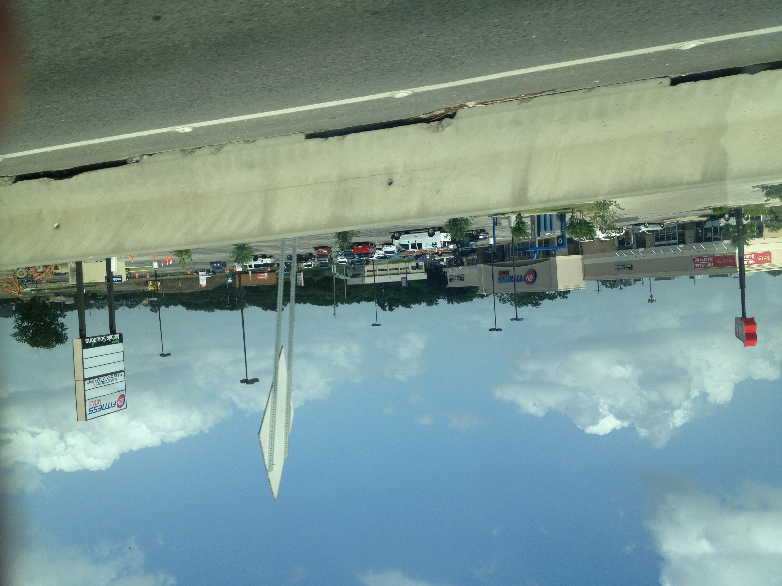
This section covers Steeple Way Boulevard to Charles Road (if Charles Road extended to Northwest Freeway). This section also covers the Northwest Village shopping center, which I'll attach as a PDF in the near future. This small part of 290 crosses through Jersey Village, which is what the Northwest Village shopping center is part of.

Eastbound (South)
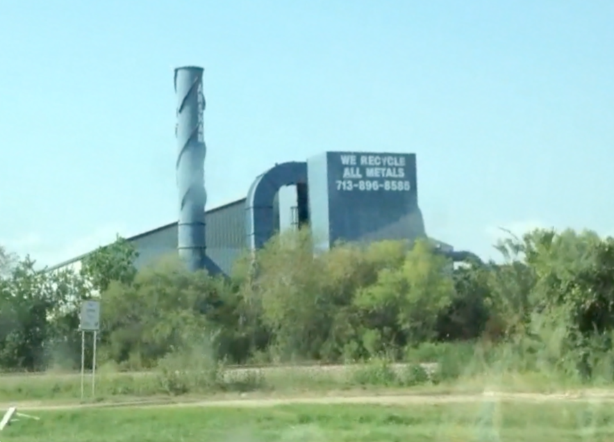
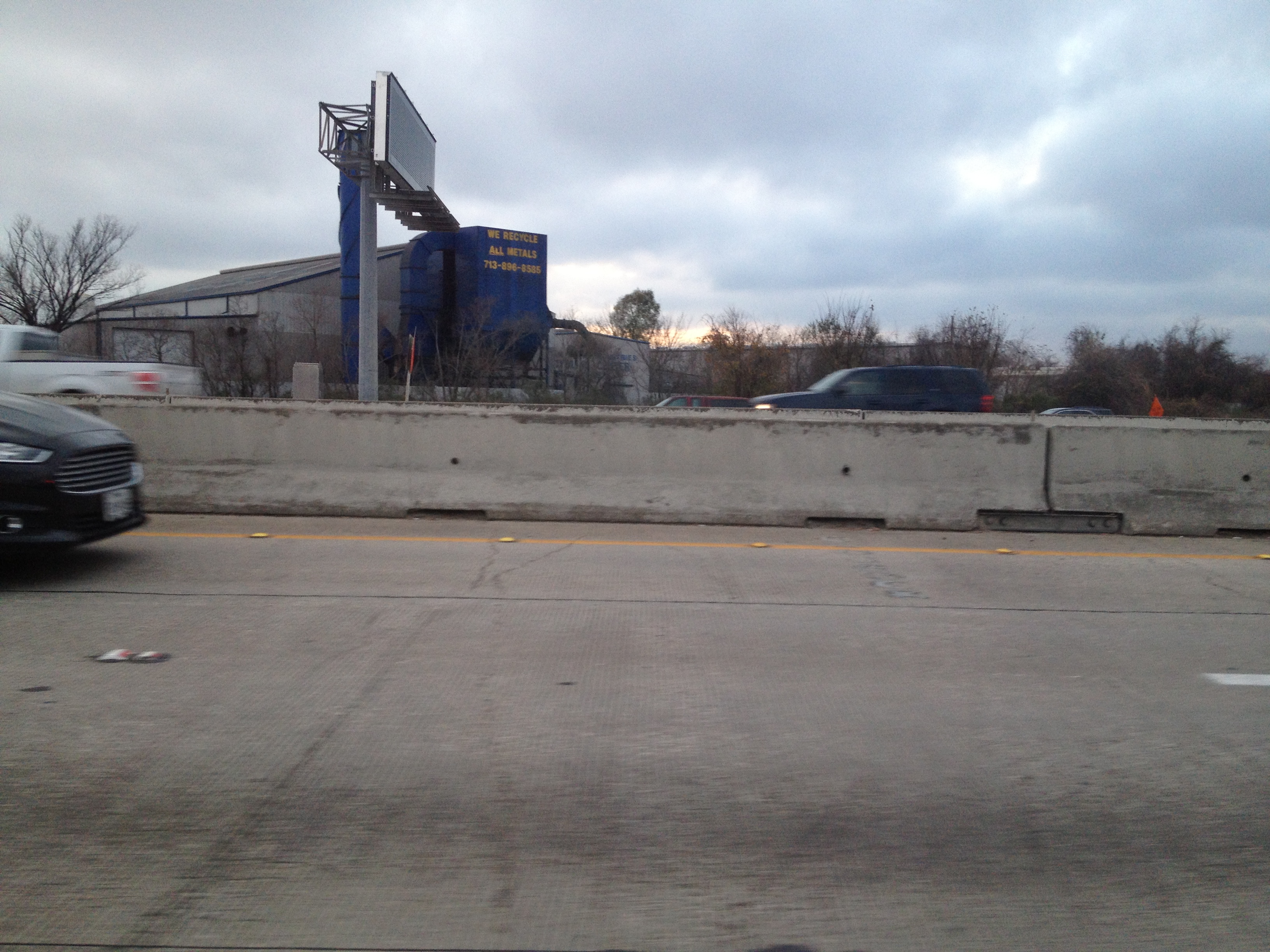
12010 Taylor Road - Gulf Pacific Rice Company (aka Sarita Rice or Gulf Rice Milling), a rice milling operation here since 1954 and built by the Moore family as a rice dryer (the grandson of the original builder still has a role at the plant!). Unfortunately, my pictures of the rice mill (Gulf Pacific since '89, when the company was founded) aren't that good. Gulf Pac has dozens of clients (even big ones like Udi's and Kelloggs) and makes most of the bagged store brand rice (not just H-E-B, but even farther away chains like Hy-Vee, and there isn't a Hy-Vee in probably a thousand miles) since switching to domestic production in the 1990s. There's trucks going in and out all the time (most of the rice is grown in Arkansas area). Gulf Pacific also has Taylor Laboratories at their address, which is an in-house testing lab for QA and testing. I visited this plant, I should know (but they never called back about the job they said they were going to offer me, a pity). There used to be a billboard for "Perry Pools" that's been there as long as I can remember, though it was torn down in 2015. I'm guessing it was torn down for the frontage road rebuild. You can see it in WHA, Google Street View, or a YouTube video I made entitled "Northwest Free" to see it though! At some point in the early 2010s, they replaced the static Gulf Pacific logo (facing south) with an LED board advertising Sarita Rice and occasionally other advertisements (job openings, employee of the month, their Twitter handle).

7935 Wright Road - Tuff Shed moved here in 2013, and features a sign that blinks rapidly (deliberately). has created a sign that blinks rapidly. It shares the address with "A Discount Storage" (or "A Discount Mini Storage") and Two Men and a Truck (a business-within-a-business at the self storage place). Tuff Shed's place prior to 2013 used to be "Houston RV Center".

7938 Wright Road - This one's a bit of a tragedy. Sparkle Sign Company was one of my favorites, for years, you could see all sorts of old signs in the back (including an old McDonald's sign), probably other treasures as well. This I also don't have a great picture for. I don't know how much stuff is in their "sign graveyard", but I would sure to see it. Unfortunately, they don't offer tours to the general public, and in summer 2018, rebranded to Signco America, presumably as part of a buyout. This not only removed all the unique and colorful signs on the 290 side of the building but even seemed to clean up the "sign graveyard", for the first time, I don't think I saw the McDonald's sign. Was it, and others, destroyed? From October 2015, here's a night shot (regrettably very blurry) of all the signs in action. Here's a bonus picture, of a Landry's sign visible from Wright Road, taken earlier that year.

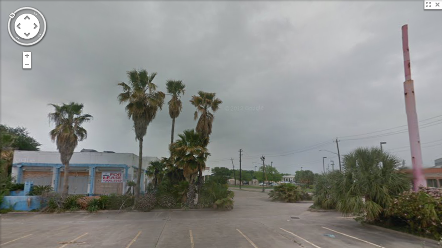
11310 Charles Road - It's unlikely you can see Weikel's Woodworks Inc. from the freeway, it's behind another business on Charles Road, but it makes cabinets.

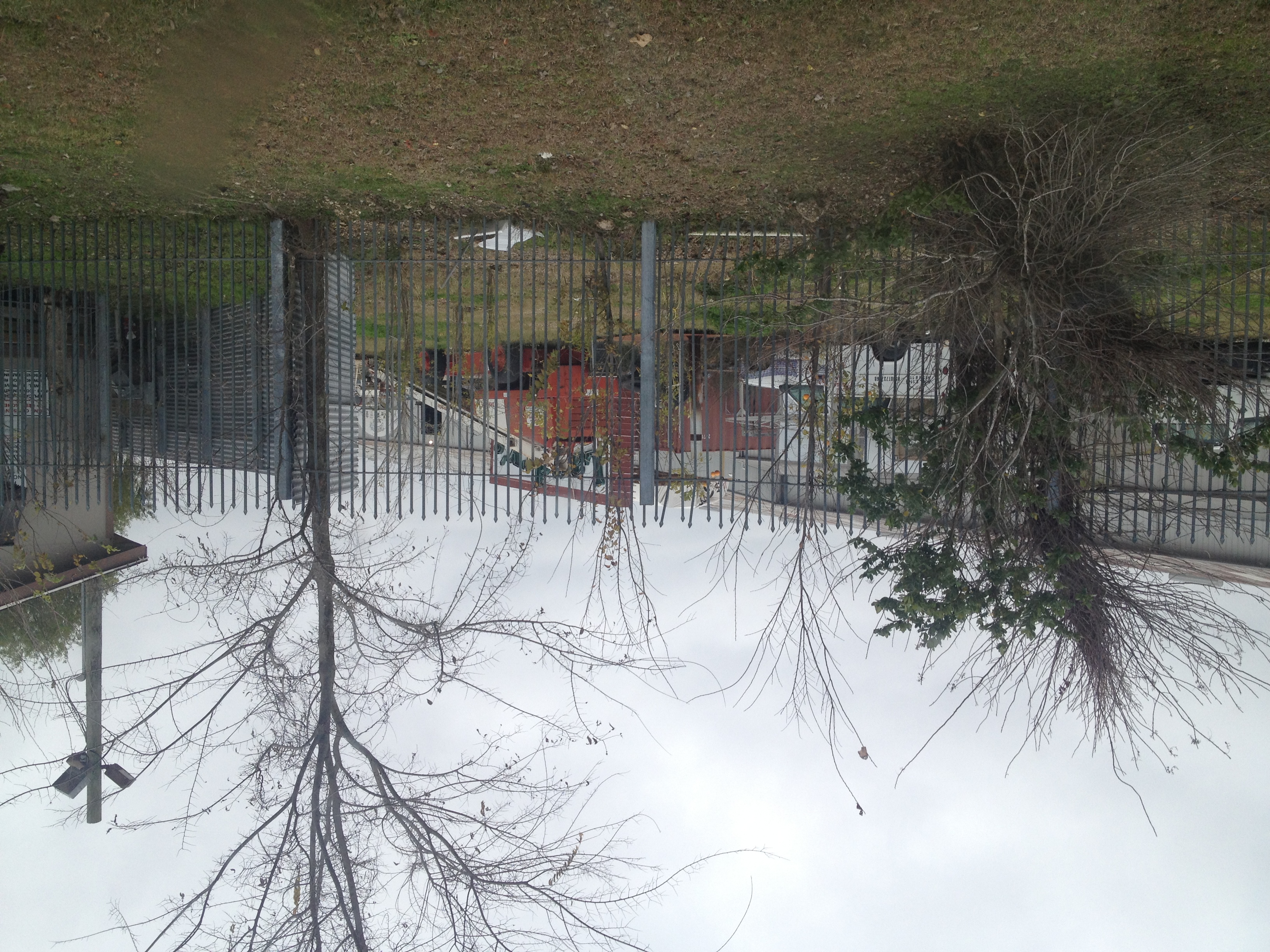
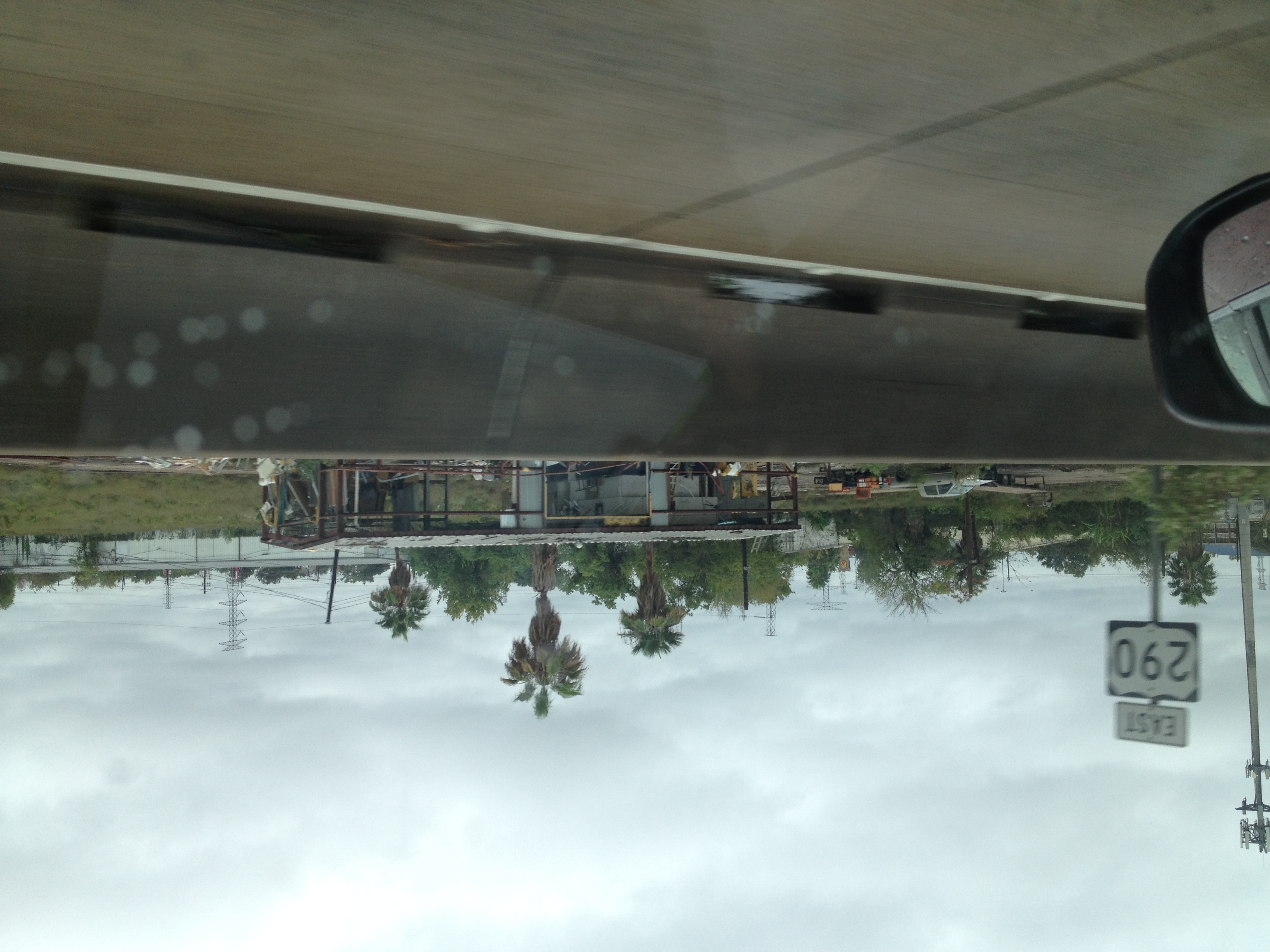
11280 Charles Road - During most evenings and afternoons you can get a good view of Arsham Scrap Metal Inc. as the traffic tends to clog up right outside of it. Here's a 2013 view from my filming attempt, but it was repainted in late 2014. Here's another picture from January 2016.

Westbound (North)
17550 - The Comfort Suites here was rebranded as Quality Suites sometime between 2011 and 2017.

17504 - The northwest corner includes a small strip with a Starbucks Coffee and for a period of at least seven years had a "Philly Connection" cheesesteak place (still around in 2015, but I'm sure there were at least two others along the 290 route in 2007-2009), and word is on HAIF that the plaza used to be one of the "unmanned gas stations" with no store and no attendant. It was a Shell, though because it was demolished in 2003, I don't remember it.

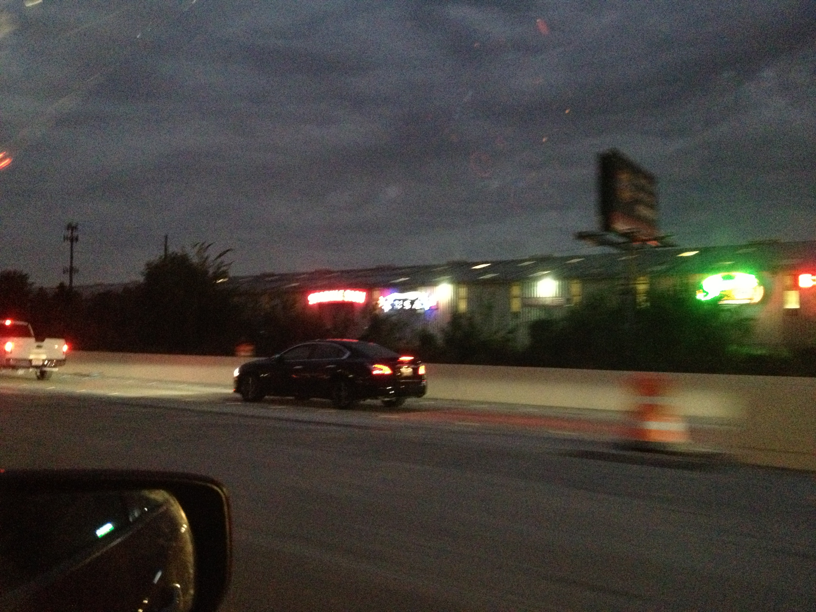
8125 Jones Road - This was originally a Burger King built in 1982, changing hands in 2004 (presumably closing in the early 2000s), and becoming Snapper Jack's Seafood & Grill in 2005 and closing in 2016, becoming a location of Mannie's Seafood, and as of 2018 is now a BreWingz location.

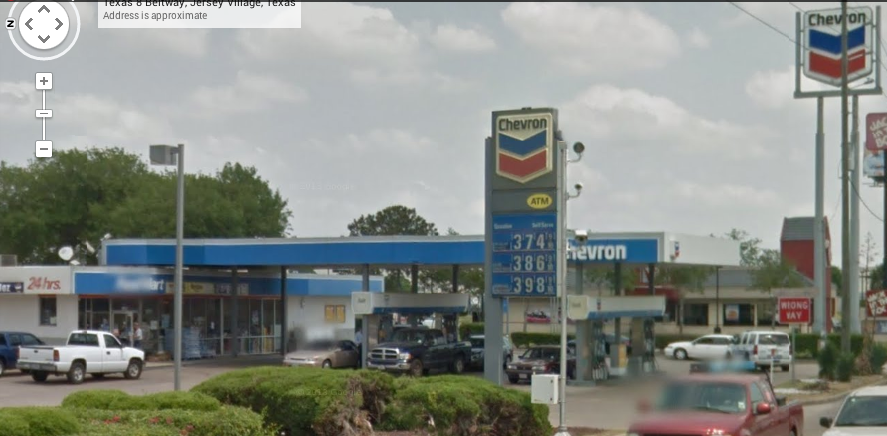
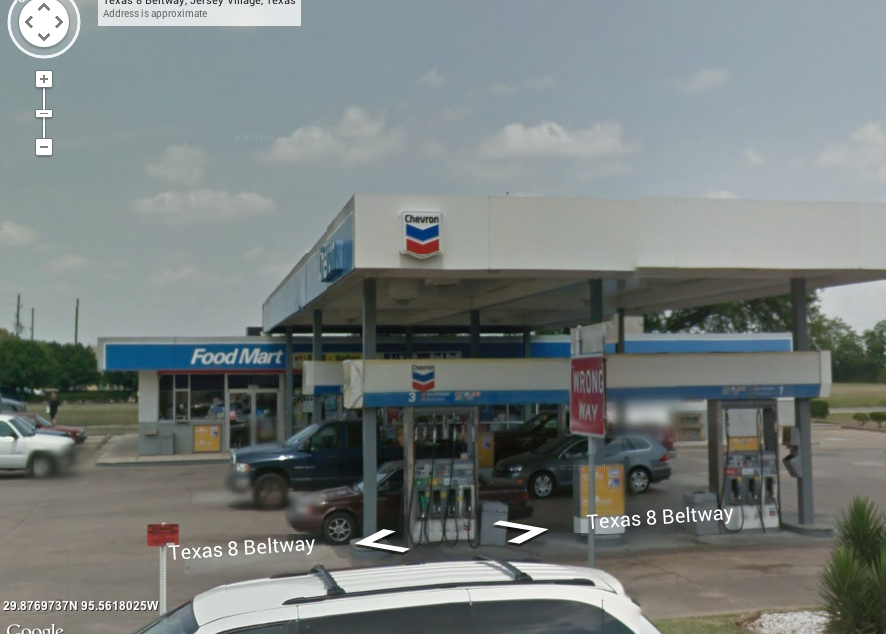
17438 - The Exxon here at the corner of Jones Road and 290 was originally not branded as a convenience store brand but by the early 2010s gained the Timewise brand a few years before it had to go for freeway widening. The Exxon sign was covered with a tarp for months before re-emerging with a new logo on the rebuilt station. The new slightly downsized lot featured a new Timewise convenience store but a permanent casualty was a drive-through car wash.

17430 - The Chick-fil-A is a small building by Chick-fil-A standards (somewhat unusual layout, no playground) and replaced a building of the strip center containing a Subway, ACE Cash Express, and a few other tenants. The whole building was 17430, suites A through F. (Subway was suite F). The original building was demolished due to freeway widening.

17410 - This address originally belonged to a Randalls (#10) until sometime in the 1990s, and based on numbering opened in the late 1970s. Today, the 17410 address is Concentra Urgent Care on the right side of the original building, most of the building (with the facade) is now Spec's Wine, Spirits, & Finer Foods at 17414 and Dollar Tree at 17418.

17390 - Exclusive Furniture started as Handy Dan Home Improvement but it moved out before the end of the 1980s. Exclusive Furniture closed in 2018 around the same time (though I think they overlapped) the Cypress location opened. For years I thought it might have been a supermarket at some point, but that didn't make sense if the Randalls was the main anchor.

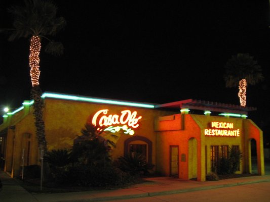
17386 - Los Cucos Mexican Cafe was a Monterey House back in 1989 and became a Monterey's Tex-Mex Cafe soon after. No other information is available.

17340 - Hartz Chicken Buffet was a Tinsley's Chicken & Rolls back in the 1980s, one of its last locations in the area before leaving town. It became Hartz sometime around 2008 (as of late 2007 it was recently-closed independent shop Burger Depot). Interestingly, I can't find what it was in 1990, as it wasn't Tinsley's, Hartz, or Church's. It may have been vacant afterward.

17234 - When the Whataburger (#501) was first built back in the 1980s, it was a Del Taco (check it out on the former restaurants page). In February 2016, that building was torn down for freeway widening and a replacement was built, opening in May 2016.

17342 - Super K Food Mart (with Valero branding) was here, having converted from a Diamond Shamrock with Stop N Go (it's unknown as to why the convenience store went independent as opposed to converting to a Corner Store, as almost all of the others did). It did end up closing due to the freeway construction in 2018 but it rebuilt as a Shell with a new convenience store (Fuel Time) with a new fuel canopy between it and Hartz.

17100 - This property was used as a location of Houston Garden Centers in the late 1990s and much of the 2000s (link) but archived searches say it's for Houston Plants & Garden rather than Houston Garden Centers, which seems more likely given a different sign and the lack of HGC's characteristic red and yellow striping. In 2017, work began on the site for Superior Subaru of Houston.

16518 Jersey Drive - What was Jersey Village Baptist Church for a number of years uses a side street as a main address instead of Northwest Freeway, since originally it was a small church at the corner of Jersey Drive and Rio Grande Street. Only around 2003 did it add a large parking lot and facade off of the freeway and in 2008 the new sanctuary building was built. According to Southern Baptist Convention's records the church was founded in 1955, but in 1953 Jersey Village hadn't even begun building the streets yet. In 2016, it became part of Champion Forest Baptist Church, and soon renamed to "Champion Forest Baptist Church - Jersey Village".

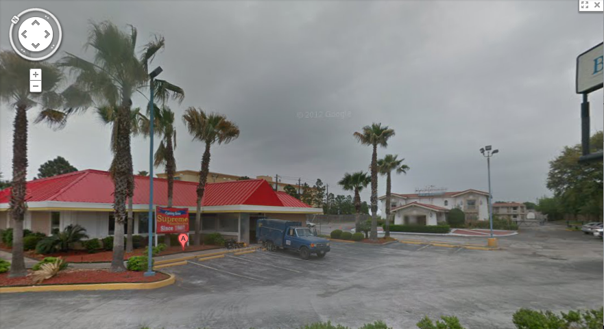
16884 - Built in 1985 as a Comfort Inn (which it was at least as of 1989), it changed hands in the early 1990s and was rebranded as Motel 6, which it would be until the summer of 2018, when it became Super 7 Inn.

16822 - Today a Taqueria Arandas, this was originally a Kettle, and closed sometime in or after 1994. By 2003 TA had taken over. Sometime around late 2014 or early 2015, the facade of the restaurant was demolished and rebuilt so the restaurant could survive the widening. This made it look less like the Kettle.

<< Back to North Eldridge Parkway and West Road
>> Next Exit: FM 529, Senate Avenue, and Sam Houston Parkway

FM 529, Senate Avenue, and Sam Houston Parkway

Author's picture from 2015.


This is one of the biggest milestones along U.S. 290, with the enormous US-290/Beltway 8 five stack. This section covers the freeway from Charles Road (again, in theory, if it crossed the railroad) up to the Little York Park & Ride ramp.

It's not that obvious from the freeway, but to get to FM 529's entrance, which has a railroad underpass, the eastbound frontage road dips down to below street level, with the section of FM 529 under the freeway going down also while being under the freeway.

Senate Avenue is just right before the Beltway, in fact, prior to late 2014, Senate Avenue just straight became the frontage roads to the Sam Houston Tollway southbound, continuous for most of the loop until the sunken part near Memorial Drive.

It may be hard to believe, but even into the 1990s and early 2000s this was where "Houston" took off. A smaller Fairfield and some highway-side development like gas stations technically existed, and of course, by FM 1960 you were definitely in developed urban territory (though even that was far less developed), but Beltway 8 was a literally physical boundary that was the guardian between "there" and "here".

Until around 2012, there were a number of large signs near Beltway 8 that protruded above the freeway, for Taco Bell, Wendy's, and McDonald's (east side), and Chevron and Jack in the Box (west side)...if you were heading southeast toward Houston. As odd as it may seem, my best memories of driving through Houston included these, especially with my then-new iPod (November 2009 en route to Louisiana!) providing memorable tunes along the way, including "Red Barchetta" and "Death and All His Friends" (Rush and Coldplay, respectively), which for years I heavily associated with this intersection.

In March 2013, I managed to finally take a picture of them, but by that time, they were already shut tight (these were shut down in fall 2012). Interestingly, the pictures by Oscar "Erik" Slotboom published on his website was taken the exact same day. What an amazing coincidence! These pictures first appeared on my College Station-centric blog, Brazos Buildings & Businesses. Some of these are my friend's pictures, but he's given me permission to use them. As they're a bit much to describe in this one page, I've written parts on the "east side" businesses, with McDonald's (16001 Northwest Freeway), Wendy's (16006 Northwest Freeway), and Taco Bell all at The Houston Files. The ultimate reason they were torn down was a new longer ramp for Gessner/Senate access, and the businesses on both sides did not have enough room. Additionally, some of my old pictures included looking looking out toward Brake Check as well as a few others from other sources, like the Google Street View of McDonald's when it was still open, with the angle of looking up the sign, as well as the Bing Birds Eye view of Wendy's and Jersey Village Automotive.

Before describing the things here, another nice part of the interchange is the stoplight-like lights on the HOT lane (best visible westbound) slowly blinking in a way older lights can. It's a bit hard to describe if you don't have nostalgia for older stoplight/railroad crossing setups.

The other businesses are described below.

Eastbound (South)
16061 - Brake Check was here at least since 1985. It closed in 2012 with a sign inviting customers to another location at North Loop West and Ella Boulevard. Northwest of the Brake Check was a gas station torn down in the early 2000s. After Brake Check was torn down, a small connector was built between Hempstead Road and the frontage road to provide easier access between the two roads.

16059 - Jersey Village Automotive was here. The location was originally built as a Jiffy Lube in the 1980s but by 1996 it became Jersey Village Automotive. There were two buildings.

After the Senate Avenue intersection, there's another gas station remnant, as well as the fast food businesses mentioned above.

Additionally, in addition to the stores and services along 290, there were some other, older businesses off of Hempstead Road. Luckily I had added them to Wikimapia back a few years ago, and in case Wikimapia disappears, here's the scoop. They weren't easily visible from 290 (Beltway 8 yes, but you had to know where to look).

14900 Hempstead Road - This one was visible from the freeway easily, a large green warehouse known as Carpet, Texas when opened in February 2001. By the time it was closed and torn down in the early 2010s, it had morphed into a location of Jack's Carpet.


Here's a few more pictures from the old page. Views from Google I've collected below.

View from Beltway 8
View from the frontage road
View from above
View from...actually, I don't know where I got this, but it's JC in the Carpet Texas days

15702 Hempstead Road- Advanced Appliance & Electronics was demolished late 2014 but closed prior to April 2011.

15620 Hempstead Road - H&S Enterprises Inc. was a machine shop.

15602 Hempstead Road - This was AIRreSOURCE LLC aka Airsource.

15301 Northwest Freeway - Stonehaven Apartments opened right on the frontage road next to the park and ride ramp around 2007. They have no other access, and because they have low-income units for rent, it was partially paid with taxpayer money. It features 192 units and originally had a drainage area/pond in front the apartments, which disappeared in favor of a new frontage road.

Westbound (North)
16884 - Nestled in the car dealerships that still stretch down 290, until summer 2018, this was a Motel 6, but became "Super 7 Inn" in summer 2018. The reviews about it aren't kind but the parking lot does connect to Jersey Drive. Originally (c. 1990) it was a Comfort Inn but by 2000 it was Motel 6.

16822 - The front of this Taqueria Arandas got mauled in the construction (it looked similar to what it does now, except it had curved "solarium" windows. It was originally a Kettle (no newspaper listings after 1994), with the first mention of it being Taqueria Arandas in 2003.

15830 - The most noteworthy thing here was a Chevron gas station, and that Chevron NEVER changed their sign from the solid red and blue when the rest did circa 2007-2008. I got a shot of the sign but better photos are from WHA and Houston Freeways (linked above). The sign existed for far longer than I expected it to, finally being torn down sometime around May 2015. Luckily, I got pictures of it and a few good views of it, and I'm thankful it stood for as long as it did. Google Maps Street View pictures are here and here. I took a few more pictures from my car, but they're not that great. Notice how the text pops out slightly: they don't make them like they used to. (August 2014, March 2015 1, March 2015 2).

15824 - The Jack in the Box was built in the mid-1990s and closed about the same time the other stores did. (#3649).

15700 - Buried between the warehouses closest to the freeway was Saint Peter's Anglican Church. The church building was torn down between 2012 and 2013, but the church relocated.

As a closing note, here's something interesting: two pictures from the perspective almost a year apart, on the WB frontage road under the five-stack before the first stoplight. There's a big difference, and it's not just between the stoplights...

Picture from March 2015 - from under the five-stack

Picture from January 2016 - from under the five-stack, same place

<< Back to Jones Road
>> Next Exit: West Little York Road and Gessner Road

West Little York Road and Gessner Road

Author's picture from 2015 at eastbound frontage road, looking southeast.


At this point prior to the construction, you entered an older part of 290, where the concrete was visibly older and the barriers (between the road and the edge of the bridge) were shorter, all traffic was shoved over part of the way to the not-quite-aligned-with-the-older-lane-striping Bott's dots on the road. This section covers everything from the Little York Park & Ride ramp to the creek near the bowling alley. The construction also rebuilt the West Little York Road bridge.

Eastbound (South)
14919 - Built in 2012, the Hilton Garden Inn (Hilton Garden Inn Houston NW America Plaza) seems to do fine while Hotel Preet across the street continues to suffer (more about Hotel Preet in the next section.

6708 Gessner Road - Courtyard by Marriott Houston NW/290 Corridor was opened in 2015.

14510 - Hightimes 24/7 Video. One of the many smutty stores along this section of 290, but as recently as 2004 it was a Verizon Wireless store (at least part of it) and in the mid-1980s (the building was built in 1980) was home to a store called The Flooring Connection.

14441 - Fair Lanes Windfern operated by Fair Lanes (a national chain of bowling alleys) opened in April 1979 as a 32 lane bowling alley. In July 1980, the bowling alley was robbed after hours and the three employees were shot in the head, execution-style. The lone survivor had to call his mother because there was no 911 system in place in Houston at the time. In the mid-1990s it became part of the AMF chain when Fair Lanes was acquired, and also received a repaint in the 2010s.

Westbound (North)
14996 - Originally a Holiday Inn from the early 1980s until sometime around 2003, 2004, my 2002 directory (of Holiday Inn) says that this had 193 rooms across three floors with exterior corridors [this right here would mean that they couldn't be a Holiday Inn after 2007 without a major re-do as the new rules required interior corridors], free parking [yes, this was listed as a feature despite being nowhere near any areas of town where parking is at a premium], a restaurant with room service, a sports bar (with complementary hors d'oeuvres), a coin laundry, and a meeting room for up to 200. The transition to "Hotel Preet" laid waste to a lot of the nicer features of the Holiday Inn, with the pool closing after 2009.

14900-92 - This strip mall, Brookhollow Village seemed mostly inactive during most of the late 2000s and early 2010s thanks to the fact the largest tenant (14900) was vacant. Originally home to a Safeway, the grocery store became AppleTree in 1989 when the Houston division of Safeway was spun off, and then Kroger after AppleTree went bankrupt and sold off most of its stores in 1994. Kroger closed around 2005, and according to HAIF it spent some time as some fly-by-night furniture stores (one search turned up "Furniture Giant"). In spring 2012, after a period of vacancy, it reopened as K1 Speed Indoor Track Racing. The strip mall also has Subway as a dining option (until relatively recently Fajita Willie's as well, now replaced by La Fogata Tex Mex Grill), as well as a few other shops, including a Jack's Carpet at 14990 which I swear did not replace the one that was torn down. What originally tipped me off to the presence of an old Safeway (and by extension, AppleTree) was its distinctive hexagon sign. The space next to the Safeway/AppleTree/Kroger/indoor go-kart track was an Eckerd back in the 1980s and 1990s, common to old Safeway stores in the Houston area. It's now an events center.

14640 - This Sherwin-Williams Paint Store is brand new compared to other buildings in this stretch.

14620 - The Rudy's Country Store & Bar-B-Q is fully featured with a gas station in front of the restaurant.

14400 - The Houston First Church of God has been around at least as long as the bowling alley has, though for some reason Google marks it as "ARABIC CHRISTIAN CHURCH HOUSTON" these days, even though they're still there just as they had been prior to 1980.


<< Back to FM 529, Senate Avenue, and Sam Houston Parkway
>> Next Exit: Fairbanks North Houston Road

Fairbanks North Houston Road

Golden Arches, but a copper roof. (2015 picture by author)


This section covers Northwest Freeway from the creek behind the bowling alley to Guhn Lane. Fairbanks North Houston is another long road, it becomes Blalock south of Hempstead Road, and Echo Lane south of Katy Freeway. To the north it goes all the way to Beltway 8 and under it, but it does not have dedicated entrance/exit ramps. All of the addresses listed are to the south side of the freeway (eastbound), the westbound only has two banks.

14225 - This opened in February 1994 as Homestead Village, a chain of extended-stay efficiency apartment hotels. In January 2001, it and others were sold to Accor, which converted them to Studio 6, which it still is today. It's worth noting that when they were converted, the Studio 6 logo was much flashier and interesting than it is today (see this 2005 picture from AARoads for an example).

14191 - Red Lobster opened their 13th area restaurant here in 1982, but by November 1995, it was closed (probably closed in part of a purge of underperforming restaurants when General Mills spun off their restaurant group). Larry's Bar-B-Q (Larry's Bar-B-Q Buffet) was open by 2003 but it would close in late 2016, and be replaced with Bombshells Restaurant & Bar, built on the exact same footprint (my guess is that Bombshells initially wanted to renovate but the extensive changes meant a rebuild instead). My picture of this restaurant (as Larry's) is found here.

14169 - Today this is a dessert place (La Monarca Michoacana) but back in 1993 it was Runaway Trains with model trains and model train accessories in HO, O, and N scale. It's part of Fairbanks Plaza (see below).


14149 - Part of the larger Fairbanks Plaza (allegedly built in 1984, but Kroger was built in 1981) is King Dollar which was open as of 2003. I'm convinced it used to be a drug store of some sort, but I can't find hard proof of that. Speaking of proof, though, in the early to mid 1990s it was "Liquor Place", a large liquor store. The King Dollar was originally "Nothing Over $1.00" (at least 1.09 as of 2008) but these days (as of this writing, using January 2019 images) is 1.25.

14147 - This has been a Jumping World for several years now (I can't find an exact opening, but evidence suggests 2013), but until 2008 or 2009 it used to be a Kroger. It used the block-lettering Kroger was known for in the early 2000s on, and received a facelift in the early 2000s that changed it from the distinct "greenhouse" it used to have. This did remain open even as Kroger had a store at West Little York a few exits up for a number of years. Even in its early days, this Kroger (according to a December 1981 ad) did not even have a full seafood department.

14101 - The Star Stop Exxon rebuilt around 2018. The rebuild featured a larger convenience store and an entrance to the back alley behind Fairbanks Plaza.

14099 - The McDonald's was built in 2007. Like many of the McDonald's built in this era (just before the "yellow eyebrow" stores). These two pictures (at the top and below) were taken in March 2015 (by me) but even in 2018 the store was renovated exterior-wise to the modern prototype. The picture below is when the sign was on the ground, but still about 7-9 feet. The sign construction was presumably when the Golden Arches were moved for highway construction.


14085 - The Home Depot was built in 1999. This is connected to a strip center out front, which include Kolache Factory.

14041 - The InTown Suites Extended Stay was built in 1998. It only has one entrance/out point onto the frontage road, there's no connection to the (former) Cavender's to the east or the Home Depot to the west.

14045 - Just past this intersection was once one of my favorite signs along the highway, as there was a little neon cowboy on top of the Cavender's Boot City freeway side sign. However, a good night shot of the sign proved too elusive. I mean, this was the best I have (July 2014), but come on--that's supposed to be a vibrant red in real life, not orange! Part of the fault is that it's a screenshot of a video, but even my attempts at still photos with my iPhone have turned red neons orange. See my Torchy's Tacos article College Station/Bryan site for another example, or the "gas prices" photo above. Sadly, in December 2015, the sign was gone and the post was being dismantled. I believed that although there was a chance, it was just removed to be reassembled away from the freeway, it was highly unlikely. I took solace in the fact that there was at least a similar sign appears to be alive and well on the Gulf Freeway, hopefully safe from highway expansions for a while, plus a newer store in Victoria, Texas (which might have been the fate of the Houston sign). In terms of this building, HCAD says it was built in 1980 and an early 1980s directory says it was "Don's Western Wear". I thought somewhere down the line Cavender's bought them up, but in 1994 Cavender's was here but Don's still had Houston locations.

14031 - In 2016, a new Cavender's Boot City was built on the other side of Flintlock Road, with the new store being a 20,000 square foot store and being much larger and more modern. I had guessed that based on the architecture this was to be the case even before the name was put up, but the big surprise came around November 2016 when the Cavender's Boot City neon sign reappeared! I was elated, but it still doesn't seem to be 100% functional at night, nor does it seem to have the same color variety the old one did. I swear the gloves aren't even yellow.

14029 - Connected to the parking lot of Cavender's Boot City has been Palace Inn, a branch of Houston's notorious local hotel chain. Screengrab from my 2014 video HERE.

14045 - This had Just Brakes in the back and Carpet Mills of America in front. Later, Carpet Mills closed and was replaced by a mattress liquidator, and in 2015 both businesses closed. In 2016, the building was torn down. See the 2014 video screengrab here.

13939 - Headquarters for Pappas Restaurants Inc.

<< Back to West Little York Road and Gessner Road
>> Next Exit: Tidwell Road and Hollister Road

Tidwell Road and Hollister Road

Originally this was a Shoney's, long since departed from the Houston area.

This next section is a large commercial corridor developed largely in the 1990s, specifically covering from Guhn Road to Northwest Central Drive. This is admittedly a bit of an abbreviated view that neglects numerous office towers, the Tinseltown theater, and a whole strip center. While it was clear that this area was up and coming in the 1990s, it's somewhat run-down area--there's usually multiple panhandlers at the intersection of Tidwell and Hollister off the freeway.

Eastbound (South)
13485 - Originally a Shoney's, this is now Mambo Seafood since around 2004 after being a Chinese restaurant for several years. (See more at The Houston Files)

13451 - The Luby's that was here was closest to their headquarters (half a mile down) closed sometime around summer 2018, a sign that the company was in real trouble and neglecting the restaurants.

13157 - The Aquarium World in this shopping center closed for good at the end of 2018. The Facebook page is archived here (why in German, I have no idea).

13013 - This office tower was built in the early 1980s with its only tenant, Harris County Appraisal District. Their website has been invaluable in the building of this site. A view from the other side (September 2018) can be seen here.

12917 - Luther's Bar-B-Q opened a location here in November 2000. In 2005, the restaurant chain was acquired by Pappas Restaurants and by 2007 was converted to Pappas Bar-B-Q.

Westbound (North)
13484 - This Walmart opened as an ordinary Wal-Mart. Later on, a Hobby Lobby was built next to it at 13470 Northwest Freeway, and eventually was demolished for an expansion to the store (becoming a Wal-Mart Supercenter before new branding changed the name again).

13480 - This Taco Cabana got the woefully bland pink sign that Taco Cabana has been replacing its signs with (replacing the neon/black versions) but it was still marked for closure anyway in January 2020.

13270 - This Whataburger appears to have been here since the mid-1990s.

13240 - An Outback Steakhouse opened here in 1993 as part of the new shopping center, but some point in the 2000s (2008 or 2009), the restaurant closed and was torn down. Chick-fil-A built a new restaurant and opened in 2010.

13232 - This Red Lobster operates in a modified building that was originally the home of sister restaurant China Coast. When Darden shut down the chain in 1995, many restaurants, including this one, were converted to Red Lobster.

12950 - Logan's Roadhouse, built in the 1990s (see Transtar Federal Credit Union below).

12930 - Transtar Federal Credit Union, picture from 2018 (by author) here. Logan's Roadhouse can be seen in the background.

12914 - Hooters was built in 1998 as a Marie Callender's restaurant (Hooters opened around 2003) and completed an inside and out renovation in 2014. These 2018 pictures reflect the 2014 appearance [signage, restaurant exterior]

12910 - Built as a Joe's Crab Shack in 1997, in 2008 the restaurant closed and was converted into a new concept by then-parent company Ignite Restaurant Group, BrickHouse Tavern + Tap. (See more at The Houston Files)

12909 - Hampton Inn, here since 1998. Despite the official branding these days as "Hampton by Hilton", the hotel kept its older and far less awkward moniker when it completed an inside-and-out renovation in 2018. The original hotel can be seen here from across the freeway. A better picture could probably be found elsewhere.

Off the Freeway
7500 West Tidwell Road - A Sonic Drive-In was built here in 1994. After it closed around 2014 (lease expiration?), it was torn down and rebuilt as Twistee Treat, a walk-up ice cream restaurant built and opened in 2016. It previously appeared that the construction just tore down the canopies and added a large ice cream sculpture on top of the kitchen building, but it does appear to be different construction.

7887 West Tidwell Road - 7887 Tidwell originally was built as a Shoney's Inn to complement the new Shoney's restaurant (despite the separation of the hotel and restaurant business by that time). Listings for Shoney's disappear after early 2000 and by the mid-2000s it was Days Inn & Suites. Today it is a Comfort Inn (officially "Comfort Inn Hwy. 290/NW").

<< Back to Fairbanks North Houston Road
>> Next Exit: Pinemont Drive, Bingle Road, and West 43rd Street


Pinemont Drive, Bingle Road, and West 43rd Street


On the frontage road south of Bingle, looking northwest (Feb. 2018 from author)

Not listed below is the Northwest Freeway Center, occupying a block of addresses at the southwest corner of West 43rd Street and Northwest Freeway. Historically, the anchors were Venture (later Big Kmart), Service Merchandise, and Toys R Us, but today are Burlington (Coat Factory), Joe V's Smart Shop, and Fallas Discount Store. Instead, pictures and more details on the Houston Files. This even goes so far back to one of the Service Merchandise stores I remember seeing along the freeway, though that's understandably a long time ago. The original signage (nothing special) was torn down in the widening, but nearly all the center's once first-line tenants have fled in relatively short order. This covers Northwest Center Drive to the creek just north of Saxon Drive and south of Chantilly Lane.

12801 - Built as a ten-story 300-room Ramada Inn in 1980 (complete with a full, multi-room suite on top of the hotel) and briefly going under the "Ramada Plaza" name from 1995 to Sept. 1999 (Ramada's top-tier hotel, at which time it adopted the Crowne Plaza name. The hotel stayed as Crowne Plaza until 2018 when a renovation began. The renovation changed the upper level as well, before the renovation you could even see chandeliers in the upper level at night sometimes. The renovation, which continued into 2019, changed the hotel into the Grand Tuscany Hotel, and removed (or enclosed, still researching) some exterior-facing hotel rooms on the southwest side.

12747 - Originally the home of Gallagher's Restaurant & Pub until around the late 1980s, the Gold Cup renovated and expanded the space in the early 1990s, converting the restaurant into a sports bar and strip club. In the mid-2010s it closed (as early as spring 2013, that's when their Facebook page stopped updating) due to the freeway widening and quickly covered with graffiti (even moreso than West Houston Archives' pictures) before TxDOT took it down in 2016. All that remains today is a gated-off parking lot surrounded by trash and a few of the palm trees that Gold Cup planted to provide for its landscaping.

12503 - Like the Chevron at Senate, the Exxon here, originally built around the late 1990s as a flagship "On the Run" store before Exxon divested them in the mid-2010s to Star Stop, this has been boarded up since around 2015 with the gas canopy gone and the vandalized convenience store (and car wash) still intact.

12445 - This automotive repair shop is listed as Northwest Shell Auto Care despite losing the Shell branding and the gas pumps years ago.

12441 - Northwest Dental Center (now closed since around the late 2010s, dentists moved out around the time all the front parking was removed) is an enigma. at 12241 Northwest Freeway had to be restaurant (it held Lee's Golden Dragons dance troupe for a while) based on its large building and larger parking lot which is of course underutilized. Unfortunately, I haven't yet found out what was there, but I'm guessing it was probably a steakhouse (it was insurance offices in the mid-1980s, which may or may not disprove my theory).

12439 - Opened 2001 as an ordinary Holiday Inn Express Hotel & Suites (attractive as far as Holiday Inn Express hotels went) and sold in 2013 (assuming the Quality Inn & Suites name that year, as it was going to lose the HI name), the hotel went through some unfortunate changes a few years after that when highway construction forced the demolition of the swimming pool (located in front of the building), the sign (forcing a replacement much closer to the building) and a covered drive-up. As an aside, my 2003 hotel guide says that this hotel contained 61 rooms spread out on three floors. The "Now Open" banner remained on the Quality Inn until it was sold again, rebranding as OYO Townhouse Houston Brookhollow. As of late 2019, renovations are ongoing.

6500 West 43rd Street - Built as the attractive Bridgegate Apartments in 1973 (complete with your choice of green or gold shag carpeting!), this apartment complex (now Vintage Apartments, as it has been since at least the late 1990s) has seen better days. Several buildings were torn down in late 2015 for freeway construction.

12191 - Hartz Chicken Buffet was at the corner of West 43rd and Northwest Freeway since the 1980s, but in 2015 it was closed and torn down.

12101 - Today known as Northwest Freeway Plaza, before its partial demolition in 2015, I had never seen so many sketchy tenants packed that close together. The pre-demolition tenants are as follows: 12151 - Cricket [some Internet records say "Best Wireless"], 12141 - Passion Spa [sign simply said PASSION, red letters on white backlit sign, Internet records say that this was an erotic massage parlor...and probably, by extension, a front for prostitution], 12131 - 3 Amigos Bonding, 12121 - Boost Mobile [Internet records also bring up "Daystar Inspections" and "Alliance Communications"], 12111 - Progressive Insurance [or says Google Street View, searching this address turns up "Jordan Insurance"], 12101 - Pronto Money [facade says "1% Checks Cashed"].

Post-demolition, Pronto Money, Progressive, and Boost remain.

11911 - Creekwood Apartments, like Bridgegate/Vintage, has befallen a similar fate, built in 1972, shag carpets as feature, had some of its units torn down during construction.

Westbound (North)
12862 - While it's a little hard to see based on my only photo from 2015, this Denny's still has its older logo above the doorway.

12830 - A second generation restaurant like others in the stretch (see Tidwell/Hollister), Twin Peaks originally opened as a T.G.I. Friday's back in 2000 but around 2011 it closed and was renovated into its current tenant (likely 2012).

12714 - Carl's Jr. opened here in 2013, one of the first Carl's Jr. stores to be built in the area. Sometime around 2018 it shuttered, with the signage painted black.

12700 - Originally home to Handy Dan Hardware. It's now 24 Hour Fitness (after serving a stint as an Academy), but it has a different address (and does not use up all the space). The Academy later moved to the old Randalls space in the next entry, while the Randalls had moved to a Kmart (also described further on), because the Kmart had moved onto the old Venture. Quite the switchover, eh? Here's a photo from 2015 from the freeway...notice that the building described below is gone with the new building yet to be built.

5101 Bingle Road - Originally built as a Champ's and later serving as Bravos Mexican Restaurant, the restaurant closed in spring 2014 with the building and its cool Wendy's-like solarium window being taken down in August of that year. A year later, a multi-tenant was built there featuring Jimmy John's, MetroPCS, and a Dunkin' Donuts/Baskin-Robbins store. The one time I personally went there, I endured the most miserable service I've ever had at a fast food restaurant and have no intention of returning.

12486 - The Wendy's has been here since 1985 (the 1990 phone book says this address is 12480 but HCAD and Wendy's corporate site disagree), though it lost the "solarium" around 2011-2012.

12460 - The green sign with a smiling flower for Natran Green Pest Control replaced the rather plain sign for the Red Onion's corporate offices, which can be seen here, from 2015.

12440 - The description for the late Cafe Red Onion from Google mentions "Hefty portions of imaginative South American fare are dished at this family-friendly cantina" but a 2008 review from Fearless Critic Houston Restaurant Guide paints a far different picture, with chicken constituting most of the menu, a high plate-split cost, and far too many mediocre items. The multiple-location restaurant is no more (the office, described above, is gone), and the space was announced to become a location of El Tiempo Cantina not long after its closure in 2015, but like Gulf Freeway, the restaurant's construction stopped and restarted, eventually opening in December 2018.

12340 - Relocated from 13388 Northwest Freeway, this new IHOP opened in 2018.

4900 Federal Plaza Drive - This Holiday Inn Express & Suites Northwest-Brookhollow began construction before the park and ride closed. I wonder if it was always the plan to build it following the ramp's closure or if they were okay with the ramp being just thirty feet away from the pool area.

6301 Pinemont Drive - Opening on March 27, 1989, the Pinemont Park & Ride was a park-and-ride lot with 1,000 parking spaces and both served as a bus terminal and an access point for Northwest Freeway's HOV lane, serving commuters for over two decades before closing on January 24, 2014, with the ramp being disassembled that spring. Since then, nothing has come of the space (low-income housing met with heavy resistance).

12230 - Lindsey's Office Furniture built around 2009-2010 is located in front of the hotels and formerly next to the Pinemont ramp. The second floor of the building appears to have never been occupied.

4850 Federal Plaza Drive - The Fairfield Inn & Suites by Marriott Houston Brookhollow was completed in 2019, well after the ramp was dismantled.

1 Justice Park Drive - After over years of construction (groundbreaking in 2004 or 2005), this branch of the Federal Bureau of Investigation opened in 2009, with walls said to be a foot thick. The architecture is strange, it's bright green and has white "+" and "#" signs built into the walls. Your tax dollars at work!

12020 - One of the first "old" McDonald's to be torn down and rebuilt in 2008 with the "yellow eyebrow", the original version of this looks like it had the drive-through actually retrofitted in later and had some sort of playground between the store and the northbound frontage road.

Off the Freeway
5302 Bingle Road - This Shipley Do-Nuts was built between 2011 and 2012. It can be seen in the background of this 2015 shot.

5305 Bingle Road - If I recall, this Greater TEXAS Credit Union was dedicated in 2009. It is a full-service bank, but interestingly, the tellers in the bank aren't visible to customers, all transactions, even inside, are handled with video communication and pneumatic tubes.

<< Back to Tidwell Road and Hollister Road
>> Next Exit: Antoine Drive and West 34th Street

Antoine Drive and West 34th Street

A 2013-era view of the Northway Shopping Center when OfficeMax was still in operation.

This section covers the area from the creek just north of Saxon Drive to the power line right of way south of Kingswood Lane. On the highway itself, this is also the new split for Interstate 10, opened sometime around 2015. Originally, US-290 ended at I-610 with a shuffle to get into I-10, but the direct ramps here changed that.

Eastbound (South)
11525 - The "old dead Chevron", as described in previous versions of this page was a Chevron because of its distinctive Chevron-shaped sign, though the "for sale" sign didn't appear until around late 2008. This one on this side of the highway closed around 2005. If you go to the page on HoustonFreeways.com regarding the 290 clearances page and scroll down toward the bottom of the page where it tells of the other Chevron that bit the dust, in the background you can see a white-looking sign with black text, that's this one. The Chevron also had an automatic car wash facility, which was razed around the same time. Less than six months before demolition, the black and white text was replaced with a colorized version. In this picture by me from May 2015, you can see the old dead Chevron from Antoine.

11321 - As of 1983, this was one of the original four Houston Patio & Garden Centers. In the late 1980s, Wolfe Nursery bought Houston Patio & Garden Centers and eventually rebranded it (after a non-compete agreement expired, the owner would form the modern Houston Garden Centers) and by 1992 this was a location of Wolfe Nursery, though by 1995 the garden center was closed. By early 1997, the property was serving as the Buff's Beach Bar restaurant, then by 2001 had become Manhattan Enterprises, a used car dealership. Sometime in the mid-2000s, the property was re-occupied by Houston Garden Centers and tore down a few buildings while bringing the property back to life (most of the back of the property wasn't utilized properly as a non-garden center). Oddly enough, this location did not appear on their website, but it operated from around 2005 to 2011. When the property was finally demolished around of November 2015, the building is being demolished, and you can see remnants of an office inside (a ceiling fan, a desk). However, prior to 2004, there was another building there different from the one recently demolished, so it served another purpose as a different business not related to vegetable plants and perennial flowers.

Last gasp of the Houston Garden Center - Picture taken May 2015.

11251 - At the northwest side is an empty office building, which was the home of HostGator.com LLC11251 Northwest Freeway) for less than a decade (the building was built in 1978). According to SpaceGhost over at Houston Historic Retail, 11251 (which initially contained HGC only on the fourth floor (moving from Florida in 2006), eventually slowly expanded throughout the building, only to leave by summer 2013 (a move to Austin was rumored in 2010, but they only established a presence there, and located elsewhere to Houston eventually). There's now a big "FOR LEASE" sign on the building now...

In this November 2015 picture, the entire building up for grabs.

11203 - This Shell closed around 2017-2018 for unknown reasons. The construction didn't actually permanently remove access points or demolish structures.

11099 - Jojo's Restaurant was here as of 1979 with three other locations elsewhere in Houston (925 N. Wilcrest, 6415 Richmond, and 12010 East Freeway). By September 1997, the chain had six locations (including Galveston) in Houston but sometime soon after it was gone, with Denny's ultimately taking over most of the locations, with them moving to this location between 2002 and 2005.

11071 - The Academy Sports + Outdoors opened around 2004 in the former spot of Randalls #1 at the Deauville-developed Northway Shopping Center (though that had itself moved from a location at Mangum and 43rd fairly early on).

11051 - The Conn's HomePlus here was originally a smaller store next to an OfficeMax (11041 Northwest Freeway), as seen here in fall 2013, which is also the main picture of this section (as it was in the original HTML version of this page). After OfficeMax closed, it absorbed the space (along with Liberty Tax Service at 11047 Northwest Freeway) and Avis Rent a Car at 11049 Northwest Freeway) to create the large Conn's (picture taken November 2015), sealing the two in-line tenants and removing the Conn's "wedge" facade. However, the OfficeMax's sub-leasing to Avis and Liberty suggested a much larger tenant there at one time, and digging reveals that the space was originally a large Sage store, with Walgreens taking over the former drugs department when the chain closed around 1980-1981. What later became the Conn's was redeveloped by the mid-1990s (likely demolishing a section of the original Sage for the store), but right now, there's not a lot of information on the turnover of these spaces.

11011 - Opened in 1977 as Clyde's Eatery (a restaurant review can be found in the April 15, 1977 edition of the Houston Chronicle), this was China Border for years until 2014 when it became home to Ty Seafood Kitchen (which closed 2017).

10999 - In the other "half" of Deauville Plaza, the Black-Eyed Pea remained here until it closed 11/27/15 (the chain functionally disappeared around a year later). It's now a location of Wings-N-Things, which moved from another restaurant building less than 300 feet away.

10903 - According to HAIFer "ldogg" was originally an Oshman's Sporting Goods, but my earliest memories involve a "Super Goodwill" (which was kind of visible on the sign until relatively recently...or it could've been "Goodwill Superstore"). It is now branded as a "Goodwill Select Store".


Eastbound (North)
11330 - HCAD's build date for this building says 1972, with the first tenant (according to a mid-1970s photograph and backed up with a directory), as "All Needz Rental". By April 1984, it was Freeman's Carpets & Interior, though a July 1984 posting also mentions a bankruptcy auction for Freeman's Piano Warehouse. By 1993, it was Maximum Discount Furniture, which eventually became Maximum Furniture. In 2013 it closed and from what I can tell was reborn on Richmond Avenue as "Houston Upholstery & Design". A house was also behind the building (pre-dating All Needz) on Milwee but it was demolished along with it.

11404 - This Chevron began life as a Gulf station back in the mid-1970s (complete with a very tall sign), and became Chevron after new ownership functionally retired the name in favor of their own. In 2013 the station closed down for redevelopment and was demolished the next year. In 2017, reusing the lot of Maximum Furniture next door and the house behind it, the station was rebuilt, with "Jack's Grocery" (a Chevron) opening by 2018. The newly built Chevron did not have a large sign like its predecessor.

11290 - Al's Formal Wear and Al's Tuxedo Outlet, which sat in the ROW in a triangular-shaped building, didn't survive ROW clearances and was one of the first freeway-related demolitions. Since I obviously didn't think about taking pictures because it was too late, there's a few Google Street View shots here and here.

11250 - Built sometime around 1973 as Romana Cafeteria (Luby's brand when entering Houston), this was later converted to Luby's Cafeteria (and eventually, just Luby's) as time went on. The Luby's corporate office has been shutting down stores left and right, so this may not survive for too much longer.

5330 West 34th Street - This Office Depot began life as Weingarten back in 1974. By 1985 (after Weingarten as a chain ceased to exist), Moore's Foods was operating in the spot. This mini-chain had two other locations, one at 301 West 11th Street (later an H-E-B Pantry before it was torn down for a bank) and at Rosenberg (the original store, evolved out of a Minimax). In 1988, Office Depot opened.

5264 West 34th Street - Originally, the end anchor was Kmart (#9646) and according to HAIFer "purpledevil", the Kmart never changed its original turquoise-and-red logo, though the building clearly expanded between 1989 and 1995 (which I would assume they DID change the logo), though by the late 1990s it would move out to a former Venture on 43rd Street. By late 2001, it was a new Randalls store, demolishing the building and making it closer to the original footprint. Furthermore, it also appears to have been one of the first Safeway-era locations but it was not really renovated to the Lifestyle format (except for a few design elements). Admittedly, I've never been to it, but it seems cold and lifeless even in the times it was still alive and well. In the spring of 2018 the store was closed, and was replaced (along with other recently-departed Randalls stores) with El Rancho Supermercado within months. It was not a total white-flag by new Randalls owner Albertsons despite what many have thought, and the fact that Albertsons owns 45% of El Rancho Supermercado indicates that it's a bit of a newer strategy.
11150 - Beyond West 34th, there's some clearances from the 290 widening, particularly Pleasures Mens Club which was demolished in January 2013 (or late December 2012). The strip club was GiGi's Cabaret originally, with the opening in 1986 as per ads. It likely did not replace anything, as in the late 1970s the land appeared to be a gas station. Today the space has been configured into 11160 Northwest Freeway, with that building holding a T-Mobile store.


5201 West 34th Street - Pinebrook Apartments (stylized as "PineBrook", at least in the early days of the apartment complex) was a 232-unit apartment complex built in 1971 (and started advertising in 1972) as one of the many apartment complexes with clubhouses, swimming pools, and shag carpeting in the early 1970s, though PineBrook was always open to families (and pets). You can see an ad here which includes a sketch of how the apartments actually looked.

The apartment complex suffered issues leading up to its official closure in November 1990 (transients moving into vacant apartments and starting fires), with (apparently) another fire happening after it was closed before the city tore it down in early 1992. A new building and parking lot (Pine Hollow Shopping Center, 5215 West 34th Street) was built soon after, and today 5201 West 34th Street is a building with Jimmy John's and a Verizon store (original tenant still unknown).

As the freeway construction did affect it, a part of the Pine Hollow Shopping Center that was torn down (RadioShack looks to be on the other side of it, at least, it was, it might have closed in the bankruptcy, though it was torn down either way). I took this Google Street View snapshot back when I was first assembling what would be this page some time ago (link to screenshot). Jason's Deli was also in this shopping center (5215 W 34th St Ste. A) before the rest of the building came down.

11120 - Casa Olé opened here by May 1998 (after 1995). It was torn down in 2013. My picture (unknown source) is here. Pictures from Google can be found here.

11020 - A Denny's was here in front of what was originally a La Quinta Inn (but of course), dating back to 1977. At some point in the early 2000s, however, it moved to a former Jojo's on the other side of the freeway (see that entry, above), and the restaurant served as a revolving door of other restaurants, first with Baytown Seafood Restaurant by January 2004 and later, Supreme Sandwiches before being evicted in 2012 and demolished in 2013. Here's a Google Maps Street View of Supreme Sandwiches prior to demolition.

11002 - The La Quinta Motor Inn (as it was originally called) behind the Denny's (as it was back then) also opened in 1977. It remained a La Quinta into the year 2000. By 2008 (even into 2011) it was a Baymont Inn, possibly converted in 2004-2005 when both chains were under the same ownership. By 2014 it had converted into a Days Inn.

10896 - Originally, Captain Benny's and an adjacent restaurant (see below) shared a parking lot, but the freeway widening took the front parking...and would affect the other restaurant too. Captain Benny's itself is in a distinctive boat-shaped building and used to be the Captain's Half Shell Oyster Bar, which used to be in Bryan too (as well as other locations in Houston).

10890 - This "other restaurant" was none other than a Taco Cabana, former Two Pesos. Of course, by the time the freeway widening actually happened, Taco Cabana had been closed and replaced with "Big Daddy's BBQ". While the building got a cheap repaint, they at least got a new sign. (Static GSV picture here).

10830 - Olive Garden ended up being almost directly on the frontage road after the clearances but still remained open.

<< Back to Pinemont Drive, Bingle Road, and West 43rd Street
>> Next Exit: Mangum Road and Dacoma Street